Port Ellen - Islay
Airport details
| Country | United Kingdom |
| State | Scotland |
| Region | EG |
| Airspace | Scottish Ctr |
| Municipality | Argyll and Bute |
| Elevation | 54ft (16m) |
| Timezone | GMT +0 |
| Coordinates | 55.68333, -6.25972 |
| Magnetic var | |
| Type | land |
| Available since | X-Plane v10.40 |
| ICAO code | EGPI |
| IATA code | ILY |
| FAA code | n/a |
Communication
| Islay Islay Fire Chief | 121.600 |
| Islay Islay Information | 123.150 |
Nearby Points of Interest:
Bowmore Town Hall
-26–29 Shore Street, Port Charlotte
-8-12 Shore Street, Port Charlotte
-Port Charlotte, Village Hall
-33–41 Main Street, Port Charlotte
-Shop And House, Post Office, Bridgend, Islay
-Islay, Bridgend, River Sorn, Bridge
-Islay, Bridgend, Sornbank
-Islay, Islay House, East Tower
-Islay House
-Islay Home Farm
-Islay, Redhouses, Woollen Mill
-Rinns of Islay
-Kildalton Cross
-Kildalton Small Cross
-Islay, Kilchiaran, Kilchiaran Farmhouse
-Emeraconart, Islay
-Islay, Kilchiaran, Kilchiaran Steading
-Kilchoman House
-Islay, Craigens
-Dunlossit House, Port Askaig, Islay
-Post Office And Shop, Houses, Port Askaig, Islay
-Jetty, Port Askaig, Islay
-Piermasters Shipping Office (D. Macbranes) House And Post Office Port Askaig
-Ardnave House
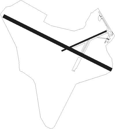
Runway info
Runway 13 / 31  | ||
| length | 1549m (5082ft) | |
| bearing | 109° / 289° | |
| width | 46m (151ft) | |
| surface | asphalt | |
| displ threshold | 141m (463ft) / 141m (463ft) | |
| Runway 08 / 26 | ||
| length | 630m (2067ft) | |
| bearing | 79° / 259° | |
| width | 18m (59ft) | |
| surface | asphalt | |
| displ threshold | 0m (0ft) / 58m (190ft) | |
Nearby beacons
| code | identifier | dist | bearing | frequency |
|---|---|---|---|---|
| ISY | DME-ILS | 0.3 | 92° | 109.95 |
| LAY | ISLAY NDB | 0.3 | 93° | 395 |
| CBL | CAMPBELTOWN NDB | 24.4 | 113° | 380 |
| MAC | MACHRIHANISH VOR/DME | 25.6 | 113° | 116 |
| EGT | LONDONDERRY NDB | 49 | 235° | 328 |
| TIR | TIREE VOR/DME | 52.8 | 323° | 117.70 |
| OBA | DME-ILS | 54.8 | 48° | 110.55 |
| OBN | OBAN NDB | 54.8 | 48° | 404 |
| OY | BELFAST/ALDERGROVE NDB | 59.7 | 170° | 332 |
Instrument approach procedures
| runway | airway (heading) | route (dist, bearing) |
|---|---|---|
| RW13 | AGBAD (93°) | AGBAD 2600ft PI13I (5mi, 65°) 2000ft |
| RW13 | DIBNU (130°) | DIBNU 3600ft PI13I (5mi, 199°) 2000ft |
| RW13 | TIKTU (109°) | TIKTU 2000ft PI13I (5mi, 109°) 2000ft |
| RNAV | PI13I 2000ft PI13F (3mi, 109°) 1600ft EGPI (5mi, 109°) 73ft PIM01 (7mi, 109°) PIM02 (5mi, 227°) TIKTU (21mi, 300°) 2000ft TIKTU (turn) | |
| RW31 | ERKEV (274°) | ERKEV 3600ft PI31I (5mi, 245°) 2000ft |
| RW31 | GITVI (289°) | GITVI 3600ft PI31I (5mi, 289°) 2000ft |
| RW31 | KELUV (309°) | KELUV 3600ft PI31I (5mi, 19°) 2000ft |
| RNAV | PI31I 2000ft PI31F (3mi, 289°) 2000ft EGPI (5mi, 289°) 89ft PIM03 (4mi, 289°) PIM04 (6mi, 227°) GITVI (19mi, 98°) 3600ft GITVI (turn) |
Disclaimer
The information on this website is not for real aviation. Use this data with the X-Plane flight simulator only! Data taken with kind consent from X-Plane 12 source code and data files. Content is subject to change without notice.