Glasgow - Glasgow Prestwick
Airport details
| Country | United Kingdom |
| State | Scotland |
| Region | EG |
| Airspace | Scottish Ctr |
| Municipality | South Ayrshire |
| Elevation | 63ft (19m) |
| Timezone | GMT +0 |
| Coordinates | 55.51259, -4.58638 |
| Magnetic var | |
| Type | land |
| Available since | X-Plane v10.40 |
| ICAO code | EGPK |
| IATA code | PIK |
| FAA code | n/a |
Communication
| Glasgow Prestwick Prestwick Information | 121.125 |
| Glasgow Prestwick Prestwick Tower | 118.150 |
| Glasgow Prestwick Prestwick Tower | 127.150 |
| Glasgow Prestwick Prestwick Approach | 129.450 |
| Glasgow Prestwick Prestwick Departure | 129.450 |
Approach frequencies
| ILS-cat-I | RW30 | 110.3 | 18.00mi |
| ILS-cat-I | RW12 | 110.3 | 18.00mi |
| 3.5° GS | RW30 | 110.3 | 18.00mi |
| 3° GS | RW12 | 110.3 | 18.00mi |
Nearby Points of Interest:
Macrae's Monument
-Shaw Monument
-St Cuthbert’s Parish Church (Prestwick)
-Prestwick, Kirk Street, Council Offices
-Auchincruive House
-Symington Parish Church
-Wallace's Monument, Ayrshire
-Barnweill Church
-Barnweill,homestead moat
-Good Shepherd Cathedral, Ayr
-Troon, St Meddans Street, Chapel Of Our Lady Of The Assumption And St Meddan
-Troon, South Beach, Town Hall
-Coodham House
-Ayr Town Hall
-Ayr, 14 Wellington Square, Sheriff Court
-Sundrum Castle
-Stair Bridge
-Stair House
-Trabboch Castle
-Irvine Old Parish Church
-Linthouse Building
-Boyd's Automatic tide signalling apparatus
-Irvine, High Street, Court House
-Kilmarnock railway viaduct
-Mauchline, Burns Monument
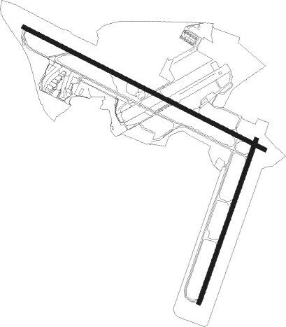
Runway info
Runway 03 / 21  | ||
| length | 1907m (6257ft) | |
| bearing | 38° / 218° | |
| width | 45m (148ft) | |
| surface | asphalt | |
| displ threshold | 79m (259ft) / 0m (0ft) | |
| blast zone | 87m (285ft) / 0m (0ft) | |
| Runway 12 / 30 | ||
| length | 2987m (9800ft) | |
| bearing | 109° / 289° | |
| width | 47m (155ft) | |
| surface | asphalt | |
| displ threshold | 250m (820ft) / 0m (0ft) | |
| blast zone | 0m (0ft) / 15m (49ft) | |
Nearby beacons
| code | identifier | dist | bearing | frequency |
|---|---|---|---|---|
| PIK | PRESTWICK NDB | 0.4 | 125° | 355 |
| DUD | DME | 2.8 | 342° | 115.45 |
| TRN | TURNBERRY VOR/DME | 13.7 | 225° | 117.50 |
| GLW | GLASGOW NDB | 22 | 23° | 331 |
| GOW | GLASGOW VOR/DME | 22 | 21° | 115.40 |
| GLO | LOWTHER DME | 29.8 | 98° | 109.65 |
| OBN | OBAN NDB | 63.1 | 319° | 404 |
| OBA | DME-ILS | 63.2 | 319° | 110.55 |
Departure and arrival routes
| Transition altitude | 6000ft |
| SID end points | distance | outbound heading | |
|---|---|---|---|
| RW12 | |||
| SUMI1L | 21mi | 109° | |
| SUDB1L | 17mi | 124° | |
| TRN2L | 14mi | 225° | |
| OKNO1L | 12mi | 238° | |
| RW30 | |||
| TRN2K | 14mi | 225° | |
| DAUN1K | 11mi | 252° | |
| STAR starting points | distance | inbound heading | |
|---|---|---|---|
| ALL | |||
| BLAC1P | 42.5 | 42° | |
| APLE2P | 93.7 | 296° | |
| RIBE2P | 120.0 | 303° | |
Instrument approach procedures
| runway | airway (heading) | route (dist, bearing) |
|---|---|---|
| RW12 | BAKAK (128°) | BAKAK 4000ft PK12I (5mi, 227°) 2300ft |
| RW12 | RELMO (108°) | RELMO 4000ft PK12I (4mi, 109°) 2300ft |
| RW12 | TRN (45°) | TRN TYSOR (7mi, 324°) 6000ft IBLOB (7mi, 324°) 4000ft PK12I (5mi, 47°) 2300ft |
| RNAV | PK12I 2300ft PK12F (4mi, 109°) 2000ft EGPK (7mi, 107°) 91ft PKE02 (6mi, 111°) PKS03 (6mi, 241°) TRN (9mi, 251°) 6000ft TRN (turn) 6000ft | |
| RW21 | ESAUL (176°) | ESAUL 4000ft BITPA (5mi, 104°) 2900ft |
| RW21 | SUMIN (289°) | SUMIN UTITI (19mi, 316°) 4000ft BITPA (5mi, 284°) 2900ft |
| RW21 | TRN (45°) | TRN GOSOB (11mi, 69°) 6000ft UTITI (14mi, 44°) 4000ft BITPA (5mi, 284°) 2900ft |
| RNAV | BITPA 2900ft PK21F (4mi, 218°) 2100ft EGPK (5mi, 226°) 110ft PKM03 (6mi, 211°) TRN (7mi, 234°) 6000ft TRN (turn) 6000ft | |
| RW30 | AMSEK (281°) | AMSEK 4500ft SKARV (4mi, 247°) 4500ft |
| RW30 | SUMIN (289°) | SUMIN PKE01 (4mi, 287°) 6000ft SKARV (2mi, 287°) 4500ft |
| RW30 | TRN (45°) | TRN ECCHO (16mi, 92°) 6000ft SKARV (6mi, 47°) 4500ft |
| RNAV | SKARV 4500ft PK30F (5mi, 289°) 3500ft EGPK (10mi, 290°) 121ft PKM01 (5mi, 286°) PKM02 (4mi, 227°) TRN (11mi, 186°) 6000ft TRN (turn) 6000ft |
Holding patterns
| STAR name | hold at | type | turn | heading* | altitude | leg | speed limit |
|---|---|---|---|---|---|---|---|
| APLE2P | TRN | NDB | left | 209 (29)° | 6000ft - 9000ft | 1.0min timed | 210 |
| BLAC1P | TRN | NDB | left | 209 (29)° | 6000ft - 9000ft | 1.0min timed | 210 |
| RIBE2P | TRN | NDB | left | 209 (29)° | 6000ft - 9000ft | 1.0min timed | 210 |
| *) magnetic outbound (inbound) holding course | |||||||
Disclaimer
The information on this website is not for real aviation. Use this data with the X-Plane flight simulator only! Data taken with kind consent from X-Plane 12 source code and data files. Content is subject to change without notice.