Balemartine - Tiree
Airport details
| Country | United Kingdom |
| State | Scotland |
| Region | EG |
| Airspace | Scottish Ctr |
| Municipality | Argyll and Bute |
| Elevation | 38ft (12m) |
| Timezone | GMT +0 |
| Coordinates | 56.49917, -6.86917 |
| Magnetic var | |
| Type | land |
| Available since | X-Plane v10.40 |
| ICAO code | EGPU |
| IATA code | TRE |
| FAA code | n/a |
Communication
| Tiree Tiree Information | 122.700 |
Nearby Points of Interest:
Hynish Harbour, Tiree
-Dun Mor a' Chaolais, broch and cup-marked rock, Millton, Tiree
-Calgary House
-Kilninian Church
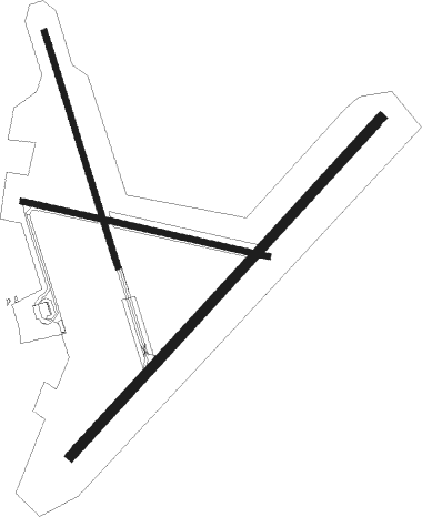
Runway info
Runway 11 / 29  | ||
| length | 809m (2654ft) | |
| bearing | 100° / 280° | |
| width | 19m (62ft) | |
| surface | asphalt | |
| Runway 05 / 23 | ||
| length | 1478m (4849ft) | |
| bearing | 63° / 243° | |
| width | 30m (98ft) | |
| surface | asphalt | |
| displ threshold | 0m (0ft) / 117m (384ft) | |
| blast zone | 199m (653ft) / 0m (0ft) | |
| Runway 17 / 35 | ||
| length | 791m (2595ft) | |
| bearing | 158° / 338° | |
| width | 18m (59ft) | |
| surface | concrete | |
Nearby beacons
| code | identifier | dist | bearing | frequency |
|---|---|---|---|---|
| TIR | TIREE VOR/DME | 0.4 | 227° | 117.70 |
| BRR | BARRA NDB | 36.9 | 312° | 316 |
| ISY | DME-ILS | 53.2 | 143° | 109.95 |
| LAY | ISLAY NDB | 53.2 | 143° | 395 |
| BCL | DME-ILS | 60.8 | 333° | 108.10 |
| BBA | BENBECULA NDB | 60.9 | 333° | 401 |
| BEN | BENBECULA VOR/DME | 60.9 | 333° | 113.95 |
Instrument approach procedures
| runway | airway (heading) | route (dist, bearing) |
|---|---|---|
| RW05 | ATMUM (63°) | ATMUM 2000ft PU05I (3mi, 63°) 1600ft |
| RW05 | GIVGI (76°) | GIVGI 2000ft PU05I (3mi, 106°) 1600ft |
| RW05 | RIMEV (45°) | RIMEV 2000ft PU05I (3mi, 323°) 1600ft |
| RNAV | PU05I 1600ft PU05F (3mi, 63°) 1600ft EGPU (5mi, 63°) 80ft PUM01 (3mi, 63°) PUM02 (3mi, 301°) GIVGI (13mi, 242°) 2000ft GIVGI (turn) 2000ft | |
| RW23 | BESNU (256°) | BESNU 2100ft PU23I (3mi, 286°) 1600ft |
| RW23 | LIVPO (243°) | LIVPO 2100ft PU23I (3mi, 243°) 1600ft |
| RW23 | MOLAL (225°) | MOLAL 2000ft PU23I (3mi, 143°) 1600ft |
| RNAV | PU23I 1600ft PU23F (3mi, 243°) 1600ft EGPU (5mi, 243°) 70ft PUM03 (4mi, 243°) PUM04 (4mi, 301°) MOLAL (13mi, 65°) 2000ft MOLAL (turn) 2000ft |
Disclaimer
The information on this website is not for real aviation. Use this data with the X-Plane flight simulator only! Data taken with kind consent from X-Plane 12 source code and data files. Content is subject to change without notice.