Shetland Islands - Unst
Airport details
| Country | United Kingdom |
| State | Scotland |
| Region | EG |
| Airspace | Scottish Ctr |
| Municipality | Shetland |
| Elevation | 62ft (19m) |
| Timezone | GMT +0 |
| Coordinates | 60.74717, -0.85383 |
| Magnetic var | |
| Type | land |
| Available since | X-Plane v10.40 |
| ICAO code | EGPW |
| IATA code | UNT |
| FAA code | n/a |
Communication
| Unst Safetycom | 135.480 |
Nearby Points of Interest:
Keen of Hamar
-Belmont House, Shetland
-Hermaness
-Yell, West Sandwick, The North Haa
-Fedeland
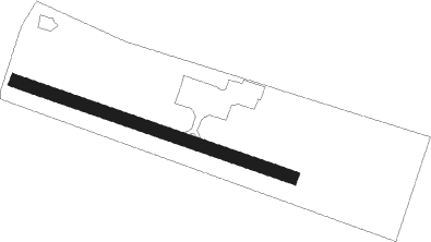
Runway info
| Runway 12 / 30 | ||
| length | 640m (2100ft) | |
| bearing | 102° / 282° | |
| width | 27m (89ft) | |
| surface | asphalt | |
| displ threshold | 31m (102ft) / 0m (0ft) | |
Nearby beacons
| code | identifier | dist | bearing | frequency |
|---|---|---|---|---|
| SBH | SUMBURGH NDB | 53.5 | 207° | 351 |
| SUM | SUMBURGH VOR/DME | 53.7 | 206° | 117.35 |
Disclaimer
The information on this website is not for real aviation. Use this data with the X-Plane flight simulator only! Data taken with kind consent from X-Plane 12 source code and data files. Content is subject to change without notice.