East Dereham - Shipdham
Airport details
| Country | United Kingdom |
| State | England |
| Region | EG |
| Airspace | London Ctr |
| Municipality | Breckland District |
| Elevation | 208ft (63m) |
| Timezone | GMT +0 |
| Coordinates | 52.62950, 0.92800 |
| Magnetic var | |
| Type | land |
| Available since | X-Plane v10.40 |
| ICAO code | EGSA |
| IATA code | n/a |
| FAA code | n/a |
Communication
| Shipdham unnamed entity | 128.800 |
Nearby Points of Interest:
Letton Hall
-East Dereham Windmill
-Great Ellingham Windmill
-Merton Hall
-Bylaugh Hall
-Sennowe Hall
-Tacolneston Hall
-East Wretham Heath
-Raynham Hall
-Earlham Hall
-Kenninghall Road Mill
-West Acre Priory
-Salle Park
-Horsford Castle
-Heydon Hall
-Rainthorpe Hall
-42-48 Bethel Street
-Aslacton Windmill
-the assembly house
-City Hall, Norwich
-St Gregory's Church
-Norwich Guildhall
-Surrey House
-Melton Constable Hall
-St. Andrew's Hall, Norwich
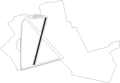
Runway info
| Runway 02 / 20 | ||
| length | 851m (2792ft) | |
| bearing | 29° / 209° | |
| width | 18m (59ft) | |
| surface | asphalt | |
| displ threshold | 91m (299ft) / 0m (0ft) | |
Nearby beacons
| code | identifier | dist | bearing | frequency |
|---|---|---|---|---|
| MAM | MARHAM TACAN | 13.4 | 273° | 108.70 |
| NWI | NORWICH NDB | 13.5 | 82° | 342 |
| LKH | LAKENHEATH TACAN | 19.2 | 240° | 110.20 |
| MLD | MILDENHALL TACAN | 22.6 | 239° | 115.90 |
| WTZ | WATTISHAM TACAN | 30.4 | 179° | 109.30 |
| CAM | CAMBRIDGE NDB | 37.1 | 241° | 332 |
| CLN | CLACTON VOR/DME | 47.5 | 164° | 114.55 |
| CGY | CONINGSBY TACAN | 48.4 | 293° | 111.10 |
| BKY | BARKWAY VOR/DME | 49.8 | 234° | 116.25 |
| WIT | WITTERING TACAN | 52 | 269° | 117.60 |
| CWL | CRANWELL NDB | 56.6 | 286° | 423 |
| CWZ | CRANWELL TACAN | 56.6 | 286° | 117.40 |
| WAD | WADDINGTON TACAN | 61.7 | 290° | 117.10 |
| LUT | LUTON NDB | 61.8 | 238° | 345 |
| CIT | CRANFIELD NDB | 62.1 | 251° | 850 |
| BPK | BROOKMANS PARK VOR/DME | 65.1 | 230° | 117.50 |
| LAM | LAMBOURNE VOR/DME | 65.6 | 218° | 115.60 |
| LE | LEICESTER NDB | 71.5 | 269° | 383 |
| KIM | HUMBERSIDE NDB | 73.1 | 306° | 365 |
Disclaimer
The information on this website is not for real aviation. Use this data with the X-Plane flight simulator only! Data taken with kind consent from X-Plane 12 source code and data files. Content is subject to change without notice.