Stapleford Tawney - Stapleford
Airport details
| Country | United Kingdom |
| State | England |
| Region | EG |
| Airspace | London Ctr |
| Municipality | Epping Forest |
| Elevation | 185ft (56m) |
| Timezone | GMT +0 |
| Coordinates | 51.65250, 0.15611 |
| Magnetic var | |
| Type | land |
| Available since | X-Plane v10.40 |
| ICAO code | EGSG |
| IATA code | n/a |
| FAA code | n/a |
Communication
| Stapleford Stapleford Radio | 122.800 |
Nearby Points of Interest:
Hainault Forest
-Bower House
-Debden House
-Chigwell Hall
-Roding Valley Meadows
-Dial House
-Epping Forest
-Havering Town Hall
-Claybury Hospital
-Hare Hall
-Ongar Castle
-Dr Barnardo's Memorial
-South Weald Camp
-Blake Hall
-The Embassy Cinema
-Dagenham Civic Centre
-Langtons
-Friday Hill House
-Valentines Mansion
-Carbis Cottage
-Bull and Crown
-Shenfield Hall
-Thorndon Park
-Chingford Reservoirs
-Snaresbrook Crown Court
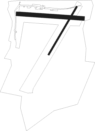
Runway info
Runway 03R / 21L  | ||
| length | 591m (1939ft) | |
| bearing | 49° / 229° | |
| width | 18m (59ft) | |
| surface | asphalt | |
| displ threshold | 0m (0ft) / 166m (545ft) | |
| Runway 10 / 28 | ||
| length | 701m (2300ft) | |
| bearing | 95° / 275° | |
| width | 46m (151ft) | |
| surface | grass | |
| displ threshold | 0m (0ft) / 205m (673ft) | |
| blast zone | 0m (0ft) / 17m (56ft) | |
Nearby beacons
| code | identifier | dist | bearing | frequency |
|---|---|---|---|---|
| LAM | LAMBOURNE VOR/DME | 0.4 | 214° | 115.60 |
| LCY | LONDON CITY NDB | 9.4 | 211° | 322 |
| BPK | BROOKMANS PARK VOR/DME | 11.3 | 290° | 117.50 |
| BIG | BIGGIN VOR/DME | 19.8 | 201° | 115.10 |
| BKY | BARKWAY VOR/DME | 20.5 | 344° | 116.25 |
| SND | SOUTHEND NDB | 20.8 | 98° | 362 |
| LUT | LUTON NDB | 21 | 301° | 345 |
| CHT | CHILTERN NDB | 25.2 | 268° | 277 |
| LON | LONDON VOR/DME | 25.2 | 255° | 113.60 |
| BNN | BOVINGDON VOR/DME | 26.6 | 276° | 113.75 |
| DET | DETLING VOR/DME | 26.6 | 128° | 117.30 |
| EPM | EPSOM NDB | 28.1 | 238° | 316 |
| OCK | OCKHAM VOR/DME | 30.7 | 240° | 115.30 |
| BUR | BURNHAM NDB | 32.1 | 261° | 421 |
| CAM | CAMBRIDGE NDB | 33.5 | 3° | 332 |
| HLS | DME | 35.1 | 135° | 115.95 |
| LSH | HEADCORN (LASHENDEN) NDB | 35.1 | 135° | 340 |
| HEN | HENTON NDB | 35.8 | 276° | 433 |
| MAY | MAYFIELD VOR/DME | 38.1 | 184° | 117.90 |
| CLN | CLACTON VOR/DME | 38.6 | 79° | 114.55 |
| CIT | CRANFIELD NDB | 39 | 304° | 850 |
| WOD | WOODLEY NDB | 40.4 | 259° | 352 |
| WTZ | WATTISHAM TACAN | 40.4 | 59° | 109.30 |
| BLC | DME | 42.3 | 252° | 116.20 |
| BLK | BLACKBUSHE NDB | 42.3 | 252° | 328 |
| WCO | WESTCOTT NDB | 43.2 | 280° | 335 |
| MLD | MILDENHALL TACAN | 44.4 | 25° | 115.90 |
| MID | MIDHURST VOR/DME | 46.3 | 233° | 114 |
| BSO | BENSON TACAN | 46.8 | 268° | 110 |
| LKH | LAKENHEATH TACAN | 47.5 | 27° | 110.20 |
| LYD | LYDD VOR/DME | 47.6 | 132° | 114.05 |
| ODH | ODIHAM TACAN | 48.4 | 249° | 109.60 |
| LZD | LYDD NDB | 50.9 | 132° | 397 |
| SRH | DME-ILS | 51.8 | 209° | 109.95 |
| SHM | SHOREHAM NDB | 51.9 | 209° | 332 |
| SFD | SEAFORD VOR/DME | 53.5 | 182° | 117 |
| DTY | DAVENTRY VOR/DME | 56.7 | 293° | 116.40 |
| GWC | GOODWOOD VOR/DME | 58.9 | 229° | 114.75 |
| MAM | MARHAM TACAN | 61.5 | 22° | 108.70 |
| WIT | WITTERING TACAN | 62.2 | 326° | 117.60 |
| LE | LEICESTER NDB | 72.1 | 309° | 383 |
Disclaimer
The information on this website is not for real aviation. Use this data with the X-Plane flight simulator only! Data taken with kind consent from X-Plane 12 source code and data files. Content is subject to change without notice.