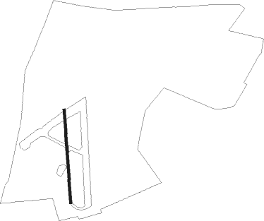
Cambridge - Bourn
Airport details
| Country | United Kingdom |
| State | England |
| Region | EG |
| Airspace | London Ctr |
| Municipality | Cambridgeshire |
| Elevation | 225ft (69m) |
| Timezone | GMT +0 |
| Coordinates | 52.21050, -0.04250 |
| Magnetic var | |
| Type | land |
| Available since | X-Plane v10.40 |
| ICAO code | EGSN |
| IATA code | n/a |
| FAA code | n/a |
Communication
| Bourn RADIO | 124.350 |
Nearby Points of Interest:
Hardwick Wood
-Bourn Hall Clinic
-Croxton Park
-Old Vicarage, Grantchester
-School of Pythagoras
-Garret Hostel Bridge Between Clare Bridge And Trinity Bridge On The Cam
-Newnham Grange
-Wren Library
-Pepys Library
-Senate House
-Cambridge Guildhall
-Cambridge Corn Exchange
-William Stone Building
-Cambridge Medical School building
-County Hall
-Memorial Chapel, The Leys School
-Scott Polar Research Institute
-Goldie Boathouse
-Festival Theatre
-Chesterton Hall
-Abbey House
-The Manor
-Cherry Hinton Hall
-Kneesworth House School
-Farm Hall
Nearby beacons
| code | identifier | dist | bearing | frequency |
|---|---|---|---|---|
| CAM | CAMBRIDGE NDB | 8.3 | 90° | 332 |
| BKY | BARKWAY VOR/DME | 13.8 | 155° | 116.25 |
| CIT | CRANFIELD NDB | 19.5 | 261° | 850 |
| LUT | LUTON NDB | 20.4 | 214° | 345 |
| MLD | MILDENHALL TACAN | 21.5 | 74° | 115.90 |
| LKH | LAKENHEATH TACAN | 24.6 | 72° | 110.20 |
| BPK | BROOKMANS PARK VOR/DME | 27.7 | 188° | 117.50 |
| WIT | WITTERING TACAN | 29.1 | 311° | 117.60 |
| MAM | MARHAM TACAN | 34.2 | 54° | 108.70 |
| BNN | BOVINGDON VOR/DME | 34.6 | 226° | 113.75 |
| LAM | LAMBOURNE VOR/DME | 34.6 | 161° | 115.60 |
| WTZ | WATTISHAM TACAN | 36.5 | 95° | 109.30 |
| HEN | HENTON NDB | 38.7 | 239° | 433 |
| CHT | CHILTERN NDB | 39.4 | 219° | 277 |
| WCO | WESTCOTT NDB | 40.2 | 249° | 335 |
| LCY | LONDON CITY NDB | 42.6 | 171° | 322 |
| LE | LEICESTER NDB | 43.4 | 292° | 383 |
| LON | LONDON VOR/DME | 46.1 | 210° | 113.60 |
| SND | SOUTHEND NDB | 47 | 131° | 362 |
| BUR | BURNHAM NDB | 47.7 | 223° | 421 |
| CWL | CRANWELL NDB | 51.6 | 331° | 423 |
| CWZ | CRANWELL TACAN | 51.7 | 332° | 117.40 |
| BIG | BIGGIN VOR/DME | 52.9 | 175° | 115.10 |
| CGY | CONINGSBY TACAN | 53 | 352° | 111.10 |
| EPM | EPSOM NDB | 54.8 | 200° | 316 |
| WOD | WOODLEY NDB | 55 | 228° | 352 |
| OCK | OCKHAM VOR/DME | 56.4 | 204° | 115.30 |
| DET | DETLING VOR/DME | 59.4 | 145° | 117.30 |
| WAD | WADDINGTON TACAN | 59.9 | 333° | 117.10 |
| BLC | DME | 61 | 222° | 116.20 |
| BLK | BLACKBUSHE NDB | 61 | 222° | 328 |
| ODH | ODIHAM TACAN | 67.6 | 223° | 109.60 |
Disclaimer
The information on this website is not for real aviation. Use this data with the X-Plane flight simulator only! Data taken with kind consent from X-Plane 12 source code and data files. Content is subject to change without notice.