Duxford
Airport details
| Country | United Kingdom |
| State | England |
| Region | EG |
| Airspace | London Ctr |
| Municipality | Cambridgeshire |
| Elevation | 125ft (38m) |
| Timezone | GMT +0 |
| Coordinates | 52.09083, 0.13194 |
| Magnetic var | |
| Type | land |
| Available since | X-Plane v10.40 |
| ICAO code | EGSU |
| IATA code | QFO |
| FAA code | n/a |
Communication
| Duxford Duxford Information | 122.075 |
Nearby Points of Interest:
Thriplow Meadows
-Brent Ditch
-Old Vicarage, Grantchester
-Nunn Wood
-Town Hall
-Cherry Hinton Hall
-Kneesworth House School
-Royston Cave
-Memorial Chapel, The Leys School
-Scott Polar Research Institute
-William Stone Building
-Hales and Shadwell Woods
-Newnham Grange
-Cambridge Medical School building
-Cambridge Corn Exchange
-Cambridge Guildhall
-Senate House
-Garret Hostel Bridge Between Clare Bridge And Trinity Bridge On The Cam
-County Hall
-Wren Library
-Festival Theatre
-Abbey House
-School of Pythagoras
-Pepys Library
-Goldie Boathouse
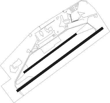
Runway info
Runway 06R / 24L  | ||
| length | 1444m (4738ft) | |
| bearing | 69° / 249° | |
| width | 31m (103ft) | |
| surface | asphalt | |
| displ threshold | 0m (0ft) / 97m (318ft) | |
| blast zone | 0m (0ft) / 47m (154ft) | |
| Runway 06L / 24R | ||
| length | 880m (2887ft) | |
| bearing | 69° / 249° | |
| width | 25m (82ft) | |
| surface | grass | |
Nearby beacons
| code | identifier | dist | bearing | frequency |
|---|---|---|---|---|
| BKY | BARKWAY VOR/DME | 6.5 | 215° | 116.25 |
| CAM | CAMBRIDGE NDB | 7.4 | 23° | 332 |
| LUT | LUTON NDB | 18.4 | 243° | 345 |
| MLD | MILDENHALL TACAN | 20.9 | 53° | 115.90 |
| BPK | BROOKMANS PARK VOR/DME | 22.3 | 215° | 117.50 |
| LKH | LAKENHEATH TACAN | 24.3 | 53° | 110.20 |
| CIT | CRANFIELD NDB | 25.5 | 273° | 850 |
| LAM | LAMBOURNE VOR/DME | 26.7 | 177° | 115.60 |
| WTZ | WATTISHAM TACAN | 29.8 | 88° | 109.30 |
| BNN | BOVINGDON VOR/DME | 33.4 | 242° | 113.75 |
| LCY | LONDON CITY NDB | 35.3 | 186° | 322 |
| MAM | MARHAM TACAN | 36.9 | 38° | 108.70 |
| CHT | CHILTERN NDB | 37 | 234° | 277 |
| SND | SOUTHEND NDB | 37.4 | 132° | 362 |
| WIT | WITTERING TACAN | 38.7 | 309° | 117.60 |
| HEN | HENTON NDB | 39.5 | 250° | 433 |
| LON | LONDON VOR/DME | 42.5 | 225° | 113.60 |
| WCO | WESTCOTT NDB | 42.9 | 258° | 335 |
| BUR | BURNHAM NDB | 45.6 | 235° | 421 |
| BIG | BIGGIN VOR/DME | 45.7 | 187° | 115.10 |
| DTY | DAVENTRY VOR/DME | 46.2 | 274° | 116.40 |
| EPM | EPSOM NDB | 49.9 | 213° | 316 |
| DET | DETLING VOR/DME | 50.3 | 149° | 117.30 |
| OCK | OCKHAM VOR/DME | 51.8 | 216° | 115.30 |
| LE | LEICESTER NDB | 52.8 | 294° | 383 |
| WOD | WOODLEY NDB | 53.6 | 238° | 352 |
| BSO | BENSON TACAN | 53.8 | 249° | 110 |
| BLC | DME | 58.7 | 232° | 116.20 |
| BLK | BLACKBUSHE NDB | 58.7 | 232° | 328 |
| HLS | DME | 59.4 | 151° | 115.95 |
| LSH | HEADCORN (LASHENDEN) NDB | 59.4 | 151° | 340 |
| CWL | CRANWELL NDB | 60.5 | 326° | 423 |
| CWZ | CRANWELL TACAN | 60.6 | 327° | 117.40 |
| ODH | ODIHAM TACAN | 65.3 | 232° | 109.60 |
Disclaimer
The information on this website is not for real aviation. Use this data with the X-Plane flight simulator only! Data taken with kind consent from X-Plane 12 source code and data files. Content is subject to change without notice.