North Weald Bassett - North Weald
Airport details
| Country | United Kingdom |
| State | England |
| Region | EG |
| Airspace | London Ctr |
| Municipality | Epping Forest |
| Elevation | 318ft (97m) |
| Timezone | GMT +0 |
| Coordinates | 51.71958, 0.14600 |
| Magnetic var | |
| Type | land |
| Available since | X-Plane v10.40 |
| ICAO code | EGSX |
| IATA code | n/a |
| FAA code | n/a |
Communication
| North Weald North Weald Radio | 123.530 |
Nearby Points of Interest:
Dial House
-Blake Hall
-Ongar Castle
-Debden House
-Hunsdon Mead
-Epping Forest
-Hunsdon House
-St James' Church
-Hainault Forest
-Rye House, Hertfordshire
-Sawbridgeworth Marsh
-Chigwell Hall
-Roding Valley Meadows
-Rawdon House
-Bower House
-St Leonard's Church, Sandridge
-Wormleybury
-South Weald Camp
-Carbis Cottage
-Claybury Hospital
-Bull and Crown
-Bell Inn
-Friday Hill House
-theobalds estate
-Chingford Reservoirs
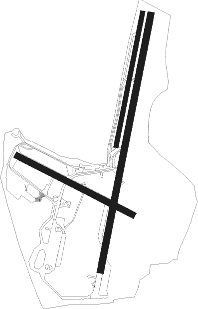
Runway info
Runway 02 / 20  | ||
| length | 1722m (5650ft) | |
| bearing | 24° / 204° | |
| width | 45m (148ft) | |
| surface | asphalt | |
| displ threshold | 186m (610ft) / 156m (512ft) | |
| Runway 12 / 30 | ||
| length | 855m (2805ft) | |
| bearing | 111° / 291° | |
| width | 41m (135ft) | |
| surface | asphalt | |
| displ threshold | 38m (125ft) / 169m (554ft) | |
| Runway 02L / 20R | ||
| length | 894m (2933ft) | |
| bearing | 24° / 204° | |
| width | 31m (102ft) | |
| surface | grass | |
Nearby beacons
| code | identifier | dist | bearing | frequency |
|---|---|---|---|---|
| LAM | LAMBOURNE VOR/DME | 4.4 | 176° | 115.60 |
| BPK | BROOKMANS PARK VOR/DME | 9.5 | 277° | 117.50 |
| LCY | LONDON CITY NDB | 13.2 | 200° | 322 |
| BKY | BARKWAY VOR/DME | 16.5 | 343° | 116.25 |
| LUT | LUTON NDB | 18.1 | 294° | 345 |
| SND | SOUTHEND NDB | 22.3 | 105° | 362 |
| BIG | BIGGIN VOR/DME | 23.7 | 196° | 115.10 |
| CHT | CHILTERN NDB | 25.4 | 262° | 277 |
| BNN | BOVINGDON VOR/DME | 25.8 | 271° | 113.75 |
| LON | LONDON VOR/DME | 26.7 | 249° | 113.60 |
| CAM | CAMBRIDGE NDB | 29.5 | 4° | 332 |
| DET | DETLING VOR/DME | 30.1 | 133° | 117.30 |
| EPM | EPSOM NDB | 30.8 | 232° | 316 |
| BUR | BURNHAM NDB | 32.9 | 256° | 421 |
| OCK | OCKHAM VOR/DME | 33.3 | 235° | 115.30 |
| HEN | HENTON NDB | 34.9 | 272° | 433 |
| CIT | CRANFIELD NDB | 35.8 | 300° | 850 |
| WTZ | WATTISHAM TACAN | 38 | 63° | 109.30 |
| HLS | DME | 38.8 | 138° | 115.95 |
| LSH | HEADCORN (LASHENDEN) NDB | 38.8 | 138° | 340 |
| MLD | MILDENHALL TACAN | 40.6 | 28° | 115.90 |
| WOD | WOODLEY NDB | 41.4 | 255° | 352 |
| WCO | WESTCOTT NDB | 41.9 | 277° | 335 |
| MAY | MAYFIELD VOR/DME | 42.1 | 182° | 117.90 |
| LKH | LAKENHEATH TACAN | 43.8 | 30° | 110.20 |
| BLC | DME | 44 | 248° | 116.20 |
| BLK | BLACKBUSHE NDB | 44 | 248° | 328 |
| BSO | BENSON TACAN | 46.8 | 265° | 110 |
| MID | MIDHURST VOR/DME | 49.3 | 229° | 114 |
| ODH | ODIHAM TACAN | 50.3 | 246° | 109.60 |
| LYD | LYDD VOR/DME | 51.2 | 134° | 114.05 |
| DTY | DAVENTRY VOR/DME | 54.2 | 290° | 116.40 |
| LZD | LYDD NDB | 54.5 | 134° | 397 |
| SRH | DME-ILS | 55.5 | 206° | 109.95 |
| SHM | SHOREHAM NDB | 55.6 | 207° | 332 |
| SFD | SEAFORD VOR/DME | 57.5 | 181° | 117 |
| MAM | MARHAM TACAN | 57.7 | 24° | 108.70 |
| WIT | WITTERING TACAN | 58.3 | 324° | 117.60 |
| GWC | GOODWOOD VOR/DME | 62 | 226° | 114.75 |
| LE | LEICESTER NDB | 68.7 | 307° | 383 |
Disclaimer
The information on this website is not for real aviation. Use this data with the X-Plane flight simulator only! Data taken with kind consent from X-Plane 12 source code and data files. Content is subject to change without notice.