Cranfield
Airport details
| Country | United Kingdom |
| State | England |
| Region | EG |
| Airspace | London Ctr |
| Municipality | Cranfield |
| Elevation | 354ft (108m) |
| Timezone | GMT +0 |
| Coordinates | 52.07222, -0.61667 |
| Magnetic var | |
| Type | land |
| Available since | X-Plane v10.40 |
| ICAO code | EGTC |
| IATA code | n/a |
| FAA code | n/a |
Communication
| Cranfield Cranfield Departure Information | 121.880 |
| Cranfield Cranfield Tower | 134.930 |
| Cranfield Cranfield Approach | 122.855 |
Approach frequencies
| ILS-cat-I | RW21 | 108.9 | 18.00mi |
| 3° GS | RW21 | 108.9 | 18.00mi |
Nearby Points of Interest:
Marston Thrift
-Tickford Bridge
-Hanger Wood
-Bow Brickhill War Memorial
-Cooper's Hill, Bedfordshire
-Linford Manor
-Woburn Abbey
-Tyringham Hall
-Gayhurst House
-Flitwick Castle
-Flitwick Moor
-Town Hall
-Bedford Civic Theatre
-Shire Hall
-Maulden Wood
-Kings and Bakers Woods and Heaths
-Haynes Park
-Double Arches Pit
-Cardington railway station
-Harlington Manor
-Cosgrove aqueduct
-Milton Ernest Hall
-Eastcotts Castle
-Cainhoe Castle
-Whaddon Hall
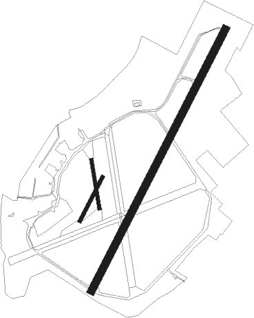
Runway info
Runway 03 / 21  | ||
| length | 1794m (5886ft) | |
| bearing | 45° / 225° | |
| width | 46m (151ft) | |
| surface | asphalt | |
| displ threshold | 202m (663ft) / 0m (0ft) | |
| Runway 03L / 21R | ||
| length | 300m (984ft) | |
| bearing | 45° / 225° | |
| width | 24m (79ft) | |
| surface | grass | |
| Runway 18L / 36R | ||
| length | 299m (981ft) | |
| bearing | 172° / 352° | |
| width | 24m (79ft) | |
| surface | grass | |
Nearby beacons
| code | identifier | dist | bearing | frequency |
|---|---|---|---|---|
| CIT | CRANFIELD NDB | 4.1 | 46° | 850 |
| LUT | LUTON NDB | 17.1 | 116° | 345 |
| WCO | WESTCOTT NDB | 18.3 | 238° | 335 |
| DTY | DAVENTRY VOR/DME | 19.4 | 282° | 116.40 |
| HEN | HENTON NDB | 19.8 | 209° | 433 |
| BNN | BOVINGDON VOR/DME | 20.9 | 169° | 113.75 |
| BKY | BARKWAY VOR/DME | 25.5 | 97° | 116.25 |
| BPK | BROOKMANS PARK VOR/DME | 27 | 122° | 117.50 |
| CHT | CHILTERN NDB | 27.2 | 168° | 277 |
| OX | OXFORD NDB | 29.8 | 251° | 367 |
| CAM | CAMBRIDGE NDB | 30.6 | 80° | 332 |
| WIT | WITTERING TACAN | 32.4 | 12° | 117.60 |
| BSO | BENSON TACAN | 32.8 | 227° | 110 |
| BUR | BURNHAM NDB | 33.3 | 186° | 421 |
| LE | LEICESTER NDB | 35.5 | 322° | 383 |
| LON | LONDON VOR/DME | 35.5 | 166° | 113.60 |
| LAM | LAMBOURNE VOR/DME | 38.3 | 119° | 115.60 |
| WOD | WOODLEY NDB | 38.4 | 203° | 352 |
| BZ | BRIZE NORTON NDB | 41.3 | 252° | 386 |
| BZN | BRIZE NORTON TACAN | 41.4 | 252° | 111.90 |
| CPT | COMPTON VOR/DME | 41.4 | 226° | 114.35 |
| LCY | LONDON CITY NDB | 42.5 | 130° | 322 |
| MLD | MILDENHALL TACAN | 44.2 | 75° | 115.90 |
| BLC | DME | 45.7 | 197° | 116.20 |
| BLK | BLACKBUSHE NDB | 45.7 | 197° | 328 |
| EPM | EPSOM NDB | 46.1 | 162° | 316 |
| OCK | OCKHAM VOR/DME | 46.5 | 168° | 115.30 |
| LKH | LAKENHEATH TACAN | 47.3 | 74° | 110.20 |
| EME | EAST MIDLANDS NDB | 50.3 | 323° | 353 |
| BIG | BIGGIN VOR/DME | 50.6 | 139° | 115.10 |
| ODH | ODIHAM TACAN | 51.9 | 202° | 109.60 |
| EMW | EAST MIDLANDS NDB | 54.8 | 312° | 393 |
| MAM | MARHAM TACAN | 55.2 | 64° | 108.70 |
| SND | SOUTHEND NDB | 57.2 | 111° | 362 |
| CWL | CRANWELL NDB | 57.4 | 8° | 423 |
| WTZ | WATTISHAM TACAN | 57.5 | 88° | 109.30 |
| CWZ | CRANWELL TACAN | 57.6 | 8° | 117.40 |
| DET | DETLING VOR/DME | 64.5 | 122° | 117.30 |
| CLN | CLACTON VOR/DME | 66.6 | 97° | 114.55 |
| HLS | DME | 72.6 | 126° | 115.95 |
| LSH | HEADCORN (LASHENDEN) NDB | 72.6 | 126° | 340 |
Instrument approach procedures
| runway | airway (heading) | route (dist, bearing) |
|---|---|---|
| RW03 | DEKAP (65°) | DEKAP 3500ft TC03I (5mi, 97°) 2500ft |
| RW03 | DOTIT (54°) | DOTIT 3500ft TC03I (5mi, 70°) 2500ft |
| RNAV | TC03I 2500ft TC03F (3mi, 45°) 2500ft EGTC (7mi, 45°) 408ft CIT (4mi, 46°) 2500ft CIT (turn) 5000ft | |
| RW21 | ADSON (197°) | ADSON 2500ft TC21I (5mi, 128°) 2500ft |
| RW21 | BAPIS (225°) | BAPIS 2500ft TC21I (6mi, 225°) 2500ft |
| RW21 | BEVLU (245°) | BEVLU 2500ft TC21I (5mi, 277°) 2500ft |
| RNAV | TC21I 2500ft TC21F (3mi, 225°) 2500ft EGTC (7mi, 225°) 412ft (3127mi, 179°) 1500ft CIT (3131mi, 359°) 2500ft CIT (turn) 5000ft |
Disclaimer
The information on this website is not for real aviation. Use this data with the X-Plane flight simulator only! Data taken with kind consent from X-Plane 12 source code and data files. Content is subject to change without notice.