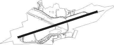
Exeter
Airport details
| Country | United Kingdom |
| State | England |
| Region | EG |
| Airspace | London Ctr |
| Municipality | East Devon |
| Elevation | 102ft (31m) |
| Timezone | GMT +0 |
| Coordinates | 50.73661, -3.40945 |
| Magnetic var | |
| Type | land |
| Available since | X-Plane v10.40 |
| ICAO code | EGTE |
| IATA code | EXT |
| FAA code | n/a |
Communication
| Exeter Exeter Information | 119.325 |
| Exeter Exeter Tower | 119.800 |
| Exeter Exeter Approach | 128.975 |
| Exeter Exter Radar | 128.975 |
Approach frequencies
| ILS-cat-I | RW08 | 109.9 | 18.00mi |
| ILS-cat-I | RW26 | 109.9 | 18.00mi |
| 3.5° GS | RW26 | 109.9 | 18.00mi |
| 3° GS | RW08 | 109.9 | 18.00mi |
Nearby Points of Interest:
Bramdean School
-Royal Devon and Exeter Hospital
-Woodbury Common, Devon
-Devon County Hall
-Higher Barracks, Exeter
-Devon and Exeter Institution
-Cathedral Close, Exeter
-Gulliford Farmhouse
-Exeter Guildhall
-Custom House, Wharfinger's House And Attached Warehouse
-Pynes House
-Bicton House, Devon
-Peamore, Exminster
-Exe Estuary
-Peak House, Sidmouth
-Kennaway House
-The Barn, Exmouth
-Hillersdon House
-Kerswell Priory
-Dawlish College
-Cotley Castle
-Downes, Crediton
-Whiteway House
-Blackborough House
-Wiscombe Park
Nearby beacons
| code | identifier | dist | bearing | frequency |
|---|---|---|---|---|
| EX | EXETER NDB | 4.4 | 82° | 337 |
| BHD | BERRY HEAD VOR/DME | 20.5 | 194° | 112.05 |
| YVL | YEOVIL NDB | 30.8 | 75° | 343 |
| YVL | DME | 31.1 | 75° | 109.05 |
| VLN | YEOVILTON TACAN | 33.3 | 71° | 111 |
| CDF | CARDIFF NDB | 39.5 | 6° | 388 |
| BRI | BRISTOL NDB | 46.7 | 47° | 414 |
| OF | FILTON NDB | 56.2 | 46° | 325 |
| BCN | BRECON VOR/DME | 59.6 | 8° | 117.45 |
Instrument approach procedures
| runway | airway (heading) | route (dist, bearing) |
|---|---|---|
| RW08 | EBOBA (81°) | EBOBA 3400ft TE08I (3mi, 81°) 2300ft |
| RW08 | OTBOT (65°) | OTBOT 3400ft TE08I (5mi, 338°) 2300ft |
| RW08 | SISRI (95°) | SISRI 3400ft TE08I (5mi, 158°) 2300ft |
| RNAV | TE08I 2300ft TE08F (5mi, 81°) 2200ft EGTE (7mi, 81°) 150ft (3052mi, 176°) 1000ft EX (3053mi, 356°) 2500ft EX (turn) | |
| RW26 | BATSU (275°) | BATSU 2800ft TE26I (5mi, 314°) 2500ft |
| RW26 | LETSI (247°) | LETSI 2800ft TE26I (5mi, 190°) 2500ft |
| RW26 | NEXAN (261°) | NEXAN 2600ft TE26I (5mi, 261°) 2500ft |
| RNAV | TE26I 2500ft TE26F (5mi, 261°) 2200ft EGTE (6mi, 262°) 160ft TEM01 (4mi, 260°) EX (8mi, 81°) 2500ft |
Disclaimer
The information on this website is not for real aviation. Use this data with the X-Plane flight simulator only! Data taken with kind consent from X-Plane 12 source code and data files. Content is subject to change without notice.
