Enstone
Airport details
| Country | United Kingdom |
| State | England |
| Region | EG |
| Airspace | London Ctr |
| Municipality | West Oxfordshire |
| Elevation | 547ft (167m) |
| Timezone | GMT +0 |
| Coordinates | 51.92817, -1.42850 |
| Magnetic var | |
| Type | land |
| Available since | X-Plane v10.40 |
| ICAO code | EGTN |
| IATA code | n/a |
| FAA code | n/a |
Communication
Nearby Points of Interest:
Kiddington Hall
-Chipping Norton Recording Studios
-Rousham House
-Bliss Tweed Mill
-Ascot d'Oilly Castle
-The Bell Inn, Long Hanborough
-Whichford House
-Middleton Park, Oxfordshire
-Eynsham Hall
-Bruern Abbey
-Daylesford House
-Kidlington railway station
-The Henry Box School
-Wroxton Abbey
-Town Hall Town Hall And Attached Walls
-Town Hall
-The Cottage
-Compton Wynyates
-Swinford Toll Bridge
-Asthall Manor
-Icomb Place
-Burford Priory
-Chacombe Priory
-Thenford House
-Battle of Stow-on-the-Wold
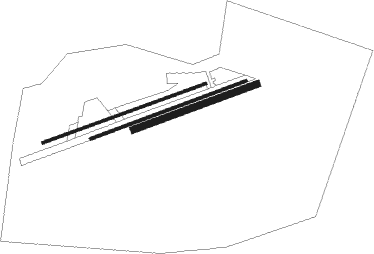
Runway info
Runway 08L / 26R  | ||
| length | 1001m (3284ft) | |
| bearing | 80° / 260° | |
| width | 18m (59ft) | |
| surface | grass | |
| Runway 08 / 26 | ||
| length | 963m (3159ft) | |
| bearing | 80° / 260° | |
| width | 18m (59ft) | |
| surface | asphalt | |
| displ threshold | 82m (269ft) / 82m (269ft) | |
| Runway 08R / 26L | ||
| length | 763m (2503ft) | |
| bearing | 80° / 260° | |
| width | 40m (131ft) | |
| surface | grass | |
Nearby beacons
| code | identifier | dist | bearing | frequency |
|---|---|---|---|---|
| OX | OXFORD NDB | 6.8 | 132° | 367 |
| BZ | BRIZE NORTON NDB | 12.5 | 224° | 386 |
| BZN | BRIZE NORTON TACAN | 12.6 | 224° | 111.90 |
| WCO | WESTCOTT NDB | 17.8 | 99° | 335 |
| DTY | DAVENTRY VOR/DME | 19 | 51° | 116.40 |
| FFA | FAIRFORD TACAN | 20.1 | 236° | 113.40 |
| BSO | BENSON TACAN | 22.4 | 134° | 110 |
| HEN | HENTON NDB | 25.7 | 105° | 433 |
| HON | HONILEY VOR/DME | 27.1 | 331° | 113.65 |
| CPT | COMPTON VOR/DME | 27.3 | 154° | 114.35 |
| GST | GLOUCESTERSHIRE NDB | 27.4 | 267° | 331 |
| BHX | BIRMINGHAM NDB | 33.7 | 328° | 406 |
| CIT | CRANFIELD NDB | 34.4 | 77° | 850 |
| BNN | BOVINGDON VOR/DME | 34.7 | 103° | 113.75 |
| WOD | WOODLEY NDB | 35.1 | 131° | 352 |
| BUR | BURNHAM NDB | 37.2 | 119° | 421 |
| CHT | CHILTERN NDB | 38.4 | 109° | 277 |
| BLC | DME | 42.3 | 136° | 116.20 |
| BLK | BLACKBUSHE NDB | 42.3 | 136° | 328 |
| LE | LEICESTER NDB | 43.2 | 30° | 383 |
| LON | LONDON VOR/DME | 44.5 | 115° | 113.60 |
| ODH | ODIHAM TACAN | 45.4 | 145° | 109.60 |
| WBA | WOLVERHAMPTON NDB | 46.7 | 305° | 356 |
| WOL | DME | 46.7 | 305° | 108.60 |
| BDN | BOSCOMBE DOWN TACAN | 48.3 | 203° | 108.20 |
| OCK | OCKHAM VOR/DME | 52.3 | 122° | 115.30 |
| WIT | WITTERING TACAN | 53.2 | 54° | 117.60 |
| EMW | EAST MIDLANDS NDB | 54 | 358° | 393 |
| TNL | TATENHILL NDB | 54.6 | 339° | 327 |
| EME | EAST MIDLANDS NDB | 54.9 | 15° | 353 |
| EAS | SOUTHAMPTON (EASTLEIGH) NDB | 58.5 | 176° | 391 |
| SAM | SOUTHAMPTON VOR/DME | 58.5 | 175° | 113.35 |
| MID | MIDHURST VOR/DME | 60.4 | 137° | 114 |
Disclaimer
The information on this website is not for real aviation. Use this data with the X-Plane flight simulator only! Data taken with kind consent from X-Plane 12 source code and data files. Content is subject to change without notice.