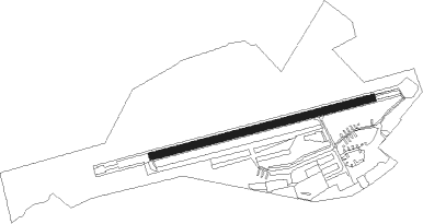
Watford - Elstree
Airport details
| Country | United Kingdom |
| State | England |
| Region | EG |
| Airspace | London Ctr |
| Municipality | Hertsmere |
| Elevation | 332ft (101m) |
| Timezone | GMT +0 |
| Coordinates | 51.65583, -0.32583 |
| Magnetic var | |
| Type | land |
| Available since | X-Plane v10.40 |
| ICAO code | EGTR |
| IATA code | n/a |
| FAA code | n/a |
Communication
Nearby Points of Interest:
Aldenham House
-The Holly Bush
-Bentley Priory Nature Reserve
-Munden House
-Seven Balls
-Ashridge Commons and Woods
-Amwell Quarry
-Watford Town Hall
-Watford Peace Memorial
-Shenley Hall
-Railway Hotel
-All Saints Pastoral Centre
-Arkley War Memorial
-Clare Hall
-Pinner House
-Queen's Head
-Garrett's Almshouses
-Whippendell Wood
-Barnet Boys School Boer War Memorial
-53 Wood Street
-North London Coroner's Court
-Church House
-Pymlicoe House
-Tudor Hall
-Old Fold Manor Golf Club House
Nearby beacons
| code | identifier | dist | bearing | frequency |
|---|---|---|---|---|
| CHT | CHILTERN NDB | 7.4 | 260° | 277 |
| BNN | BOVINGDON VOR/DME | 9.3 | 287° | 113.75 |
| BPK | BROOKMANS PARK VOR/DME | 9.9 | 67° | 117.50 |
| LON | LONDON VOR/DME | 11.4 | 220° | 113.60 |
| LUT | LUTON NDB | 14.5 | 17° | 345 |
| BUR | BURNHAM NDB | 15.4 | 249° | 421 |
| LCY | LONDON CITY NDB | 17.2 | 111° | 322 |
| LAM | LAMBOURNE VOR/DME | 17.8 | 91° | 115.60 |
| HEN | HENTON NDB | 18.3 | 283° | 433 |
| EPM | EPSOM NDB | 20.2 | 188° | 316 |
| OCK | OCKHAM VOR/DME | 21.5 | 199° | 115.30 |
| BIG | BIGGIN VOR/DME | 23.7 | 132° | 115.10 |
| WOD | WOODLEY NDB | 23.9 | 250° | 352 |
| BKY | BARKWAY VOR/DME | 24.6 | 49° | 116.25 |
| WCO | WESTCOTT NDB | 26.4 | 287° | 335 |
| BLC | DME | 27.8 | 237° | 116.20 |
| BLK | BLACKBUSHE NDB | 27.8 | 237° | 328 |
| BSO | BENSON TACAN | 28.9 | 267° | 110 |
| CIT | CRANFIELD NDB | 29.7 | 334° | 850 |
| ODH | ODIHAM TACAN | 34.4 | 236° | 109.60 |
| CPT | COMPTON VOR/DME | 34.7 | 260° | 114.35 |
| MID | MIDHURST VOR/DME | 37.8 | 206° | 114 |
| CAM | CAMBRIDGE NDB | 38.2 | 43° | 332 |
| OX | OXFORD NDB | 38.5 | 280° | 367 |
| SND | SOUTHEND NDB | 38.5 | 94° | 362 |
| DET | DETLING VOR/DME | 40.4 | 111° | 117.30 |
| MAY | MAYFIELD VOR/DME | 41.7 | 145° | 117.90 |
| DTY | DAVENTRY VOR/DME | 42.9 | 304° | 116.40 |
| HLS | DME | 47.3 | 117° | 115.95 |
| LSH | HEADCORN (LASHENDEN) NDB | 47.3 | 117° | 340 |
| SHM | SHOREHAM NDB | 49.2 | 178° | 332 |
| SRH | DME-ILS | 49.2 | 178° | 109.95 |
| GWC | GOODWOOD VOR/DME | 50.7 | 208° | 114.75 |
| MLD | MILDENHALL TACAN | 52 | 49° | 115.90 |
| WTZ | WATTISHAM TACAN | 54.6 | 70° | 109.30 |
| LKH | LAKENHEATH TACAN | 55.4 | 49° | 110.20 |
| CLN | CLACTON VOR/DME | 55.9 | 83° | 114.55 |
| SFD | SEAFORD VOR/DME | 56.3 | 153° | 117 |
| WIT | WITTERING TACAN | 57.5 | 350° | 117.60 |
| LYD | LYDD VOR/DME | 59.9 | 119° | 114.05 |
| LE | LEICESTER NDB | 62.7 | 323° | 383 |
| LZD | LYDD NDB | 63.3 | 119° | 397 |
| MAM | MARHAM TACAN | 67.9 | 42° | 108.70 |
Disclaimer
The information on this website is not for real aviation. Use this data with the X-Plane flight simulator only! Data taken with kind consent from X-Plane 12 source code and data files. Content is subject to change without notice.