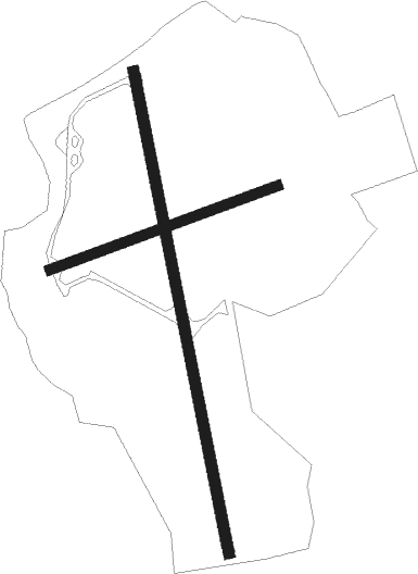
Abingdon - Abingdon Dalton Barracks
Airport details
| Country | United Kingdom |
| State | England |
| Region | EG |
| Airspace | London Ctr |
| Municipality | Vale of White Horse |
| Elevation | 229ft (70m) |
| Timezone | GMT +0 |
| Coordinates | 51.69641, -1.31768 |
| Magnetic var | |
| Type | land |
| Available since | X-Plane v10.40 |
| ICAO code | EGUD |
| IATA code | n/a |
| FAA code | n/a |
Communication
Nearby Points of Interest:
Cosener's House
-Abingdon Bridge
-Abingdon Abbey
-Culham Manor
-Manor House
-The Abbey, Sutton Courtenay
-Osney Abbey
-Littlemore Hospital
-Carfax Conduit
-University College Boathouse
-Folly Bridge
-Nuneham House
-Newbridge
-The Old Palace, Bishop Kings Palace
-County Hall
-Buildings of Nuffield College, Oxford
-Rewley Road Swing Bridge
-Tom Quad
-Blue Boar Quadrangle
-Oxford Town Hall
-Christ Church Library
-Canterbury Quadrangle
-Peckwater Quadrangle
-Upplands runinskrifter 104
-Radcliffe Quadrangle

Nearby beacons
| code | identifier | dist | bearing | frequency |
|---|---|---|---|---|
| OX | OXFORD NDB | 8.2 | 358° | 367 |
| BSO | BENSON TACAN | 9.5 | 111° | 110 |
| BZ | BRIZE NORTON NDB | 11 | 281° | 386 |
| BZN | BRIZE NORTON TACAN | 11 | 280° | 111.90 |
| CPT | COMPTON VOR/DME | 12.8 | 154° | 114.35 |
| WCO | WESTCOTT NDB | 16.2 | 66° | 335 |
| FFA | FAIRFORD TACAN | 17.8 | 268° | 113.40 |
| HEN | HENTON NDB | 19.9 | 83° | 433 |
| WOD | WOODLEY NDB | 21.9 | 119° | 352 |
| BUR | BURNHAM NDB | 26.1 | 105° | 421 |
| BLC | DME | 28.5 | 128° | 116.20 |
| BLK | BLACKBUSHE NDB | 28.5 | 128° | 328 |
| BNN | BOVINGDON VOR/DME | 28.6 | 88° | 113.75 |
| CHT | CHILTERN NDB | 30 | 95° | 277 |
| DTY | DAVENTRY VOR/DME | 30 | 23° | 116.40 |
| ODH | ODIHAM TACAN | 31 | 141° | 109.60 |
| GST | GLOUCESTERSHIRE NDB | 33.6 | 283° | 331 |
| LON | LONDON VOR/DME | 34.1 | 104° | 113.60 |
| BDN | BOSCOMBE DOWN TACAN | 36.7 | 218° | 108.20 |
| CIT | CRANFIELD NDB | 38.3 | 60° | 850 |
| OCK | OCKHAM VOR/DME | 40.1 | 114° | 115.30 |
| HON | HONILEY VOR/DME | 41.6 | 332° | 113.65 |
| EPM | EPSOM NDB | 41.9 | 112° | 316 |
| EAS | SOUTHAMPTON (EASTLEIGH) NDB | 44.5 | 183° | 391 |
| SAM | SOUTHAMPTON VOR/DME | 44.5 | 182° | 113.35 |
| MID | MIDHURST VOR/DME | 46.5 | 133° | 114 |
| BHX | BIRMINGHAM NDB | 48.2 | 330° | 406 |
| GWC | GOODWOOD VOR/DME | 54.7 | 146° | 114.75 |
| LE | LEICESTER NDB | 55.6 | 17° | 383 |
| BIA | BOURNEMOUTH NDB | 58.5 | 210° | 339 |
| WBA | WOLVERHAMPTON NDB | 60.2 | 311° | 356 |
| WOL | DME | 60.2 | 311° | 108.60 |
| WIT | WITTERING TACAN | 62.5 | 42° | 117.60 |
Disclaimer
The information on this website is not for real aviation. Use this data with the X-Plane flight simulator only! Data taken with kind consent from X-Plane 12 source code and data files. Content is subject to change without notice.