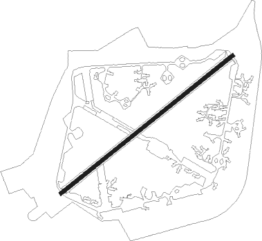
Lakenheath - Raf Lakenheath
Airport details
| Country | United Kingdom |
| State | England |
| Region | EG |
| Airspace | London Ctr |
| Municipality | West Suffolk |
| Elevation | 32ft (10m) |
| Timezone | GMT +0 |
| Coordinates | 52.40933, 0.56100 |
| Magnetic var | |
| Type | land |
| Available since | X-Plane v10.40 |
| ICAO code | EGUL |
| IATA code | LKZ |
| FAA code | n/a |
Communication
| RAF Lakenheath Lakenheath Tower | 122.100 |
| RAF Lakenheath Lakenheath Approach | 136.500 |
| RAF Lakenheath Lakenheath Radar | 128.900 |
Approach frequencies
| ILS-cat-I | RW06 | 109.9 | 18.00mi |
| ILS-cat-I | RW24 | 109.9 | 18.00mi |
| 3° GS | RW06 | 109.9 | 18.00mi |
| 3° GS | RW24 | 109.9 | 18.00mi |
Nearby Points of Interest:
Foxhole Heath
-Berner's Heath
-Elveden Hall
-Guildhall
-Thetford Castle
-West Stow Hall
-Black Ditches, Cavenham
-Culford Park
-Kilverstone Hall
-Euston Hall
-Ampton Hall
-East Wretham Heath
-Dalham Hall
-Bishop's Palace Bishop's Palace (the Palace School)
-Lower Mill, Dalham
-Market Cross
-Northgate House
-Pillar of Salt
-Bury St Edmunds Guildhall
-Spinney Abbey
-Ryston Hall
-Winnold House
-Merton Hall
-Crimplesham Hall
-Nether Hall
Nearby beacons
| code | identifier | dist | bearing | frequency |
|---|---|---|---|---|
| LKH | LAKENHEATH TACAN | 0.5 | 257° | 110.20 |
| MLD | MILDENHALL TACAN | 3.8 | 238° | 115.90 |
| MAM | MARHAM TACAN | 14.2 | 360° | 108.70 |
| CAM | CAMBRIDGE NDB | 18.2 | 242° | 332 |
| WTZ | WATTISHAM TACAN | 22.1 | 127° | 109.30 |
| BKY | BARKWAY VOR/DME | 31.1 | 230° | 116.25 |
| NWI | NORWICH NDB | 31.1 | 70° | 342 |
| CLN | CLACTON VOR/DME | 40 | 134° | 114.55 |
| WIT | WITTERING TACAN | 40.5 | 281° | 117.60 |
| LUT | LUTON NDB | 43 | 238° | 345 |
| CIT | CRANFIELD NDB | 44.3 | 256° | 850 |
| BPK | BROOKMANS PARK VOR/DME | 46.6 | 225° | 117.50 |
| LAM | LAMBOURNE VOR/DME | 48.2 | 208° | 115.60 |
| CGY | CONINGSBY TACAN | 48.7 | 313° | 111.10 |
| SND | SOUTHEND NDB | 50.3 | 171° | 362 |
| CWL | CRANWELL NDB | 53.2 | 300° | 423 |
| CWZ | CRANWELL TACAN | 53.2 | 301° | 117.40 |
| LCY | LONDON CITY NDB | 57.3 | 209° | 322 |
| BNN | BOVINGDON VOR/DME | 58 | 238° | 113.75 |
| LE | LEICESTER NDB | 59.5 | 277° | 383 |
| WAD | WADDINGTON TACAN | 60.1 | 305° | 117.10 |
| CHT | CHILTERN NDB | 61.8 | 234° | 277 |
| DTY | DAVENTRY VOR/DME | 63 | 262° | 116.40 |
| HEN | HENTON NDB | 63.3 | 244° | 433 |
| WCO | WESTCOTT NDB | 65.3 | 250° | 335 |
| LON | LONDON VOR/DME | 67.1 | 228° | 113.60 |
| EME | EAST MIDLANDS NDB | 68.8 | 284° | 353 |
| BUR | BURNHAM NDB | 70.4 | 234° | 421 |
Departure and arrival routes
| Transition altitude | 3000ft |
| SID end points | distance | outbound heading | |
|---|---|---|---|
| RW06 | |||
| IPKOP1 | 19mi | 80° | |
| TIDP1A | 29mi | 97° | |
| RW24 | |||
| ASRO1B | 25mi | 292° | |
Instrument approach procedures
| runway | airway (heading) | route (dist, bearing) |
|---|---|---|
| RW06 | ELNAV (96°) | ELNAV INDIV (16mi, 122°) |
| RNAV | INDIV BIDNU (7mi, 67°) 1900ft EGUL (6mi, 67°) 82ft (3148mi, 181°) 600ft ELNAV (3151mi, 360°) ELNAV (turn) | |
| RW24 | OGKOW (247°) | OGKOW UZZAG (8mi, 248°) 2800ft |
| RNAV | UZZAG 2800ft LUGED (5mi, 247°) 1300ft EGUL (5mi, 247°) 85ft (3148mi, 181°) 700ft INPOT (3150mi, 0°) INPOT (turn) |
Disclaimer
The information on this website is not for real aviation. Use this data with the X-Plane flight simulator only! Data taken with kind consent from X-Plane 12 source code and data files. Content is subject to change without notice.