Cosford - Raf Cosford
Airport details
| Country | United Kingdom |
| State | England |
| Region | EG |
| Airspace | London Ctr |
| Municipality | Shropshire |
| Elevation | 270ft (82m) |
| Timezone | GMT +0 |
| Coordinates | 52.64177, -2.31552 |
| Magnetic var | |
| Type | land |
| Available since | X-Plane v10.40 |
| ICAO code | EGWC |
| IATA code | n/a |
| FAA code | n/a |
Communication
| RAF Cosford Cosford Ground | 128.600 |
| RAF Cosford Cosford Tower | 128.650 |
| RAF Cosford Cosford Approach | 135.875 |
Nearby Points of Interest:
Grotto At Sj 7756 0290
-Patshull Hall
-St Mary's Church, Patshull
-Haughton Hall
-Wrottesley Hall
-Black Ladies Priory
-Chillington Hall
-Madeley Court
-Mottey Meadows
-Davenport House
-Apley Hall
-Stretton Aqueduct
-Lilleshall Hall
-Ironbridge Gorge
-Coalbrookdale Institute
-Somerford Hall
-St Leonard's Church, Linley
-Stretton Hall, Staffordshire
-Sutherland Monument
-Catholic Church of St Peter and St Paul
-Wolverhampton Civic Hall
-The Law Courts
-Wolverhampton Pillar
-Chubb Locks
-Queen's Building, Wolverhampton
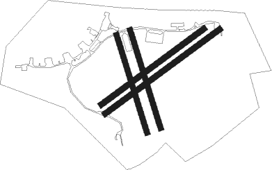
Runway info
Runway 06 / 24  | ||
| length | 1148m (3766ft) | |
| bearing | 69° / 249° | |
| width | 46m (151ft) | |
| surface | asphalt | |
| displ threshold | 20m (66ft) / 33m (108ft) | |
| Runway 06L / 24R | ||
| length | 1029m (3376ft) | |
| bearing | 69° / 249° | |
| width | 45m (148ft) | |
| surface | grass | |
| Runway 18R / 36L | ||
| length | 828m (2717ft) | |
| bearing | 160° / 340° | |
| width | 46m (151ft) | |
| surface | grass | |
| Runway 18L / 36R | ||
| length | 831m (2726ft) | |
| bearing | 160° / 340° | |
| width | 46m (151ft) | |
| surface | grass | |
Nearby beacons
| code | identifier | dist | bearing | frequency |
|---|---|---|---|---|
| WBA | WOLVERHAMPTON NDB | 7.8 | 157° | 356 |
| WOL | DME | 7.8 | 157° | 108.60 |
| SWB | SHAWBURY VOR/DME | 15.7 | 294° | 116.80 |
| TNL | TATENHILL NDB | 22.4 | 72° | 327 |
| BHX | BIRMINGHAM NDB | 23.4 | 108° | 406 |
| HON | HONILEY VOR/DME | 29.3 | 114° | 113.65 |
| WPL | WELSHPOOL NDB | 30.5 | 269° | 323 |
| SH | SHOBDON NDB | 31.6 | 235° | 426 |
| EMW | EAST MIDLANDS NDB | 33.2 | 78° | 393 |
| TNT | TRENT VOR/DME | 34 | 57° | 115.70 |
| WHI | WHITEGATE NDB | 34.4 | 330° | 368 |
| HAW | HAWARDEN NDB | 40.2 | 309° | 340 |
| MCT | MANCHESTER VOR/DME | 42.9 | 4° | 113.55 |
| LPL | LIVERPOOL NDB | 44.4 | 330° | 349 |
| GST | GLOUCESTERSHIRE NDB | 45.3 | 169° | 331 |
| WAL | WALLASEY VOR/DME | 53.8 | 312° | 114.10 |
| BZ | BRIZE NORTON NDB | 59.6 | 141° | 386 |
| BZN | BRIZE NORTON TACAN | 59.7 | 141° | 111.90 |
| FFA | FAIRFORD TACAN | 60.7 | 152° | 113.40 |
| OX | OXFORD NDB | 60.7 | 129° | 367 |
| BCN | BRECON VOR/DME | 65.1 | 226° | 117.45 |
Disclaimer
The information on this website is not for real aviation. Use this data with the X-Plane flight simulator only! Data taken with kind consent from X-Plane 12 source code and data files. Content is subject to change without notice.