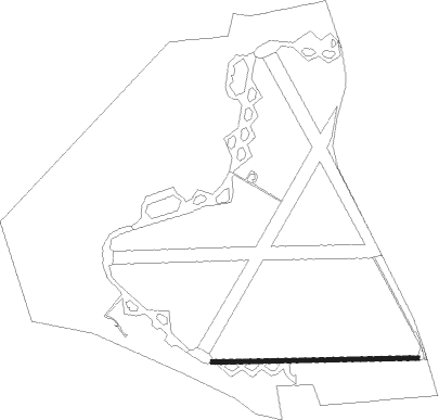
Nawton - Wombleton
Airport details
| Country | United Kingdom |
| State | England |
| Region | |
| Airspace | London Ctr |
| Municipality | Ryedale |
| Elevation | 120ft (37m) |
| Timezone | GMT +0 |
| Coordinates | 54.22865, -0.97663 |
| Magnetic var | |
| Type | land |
| Available since | X-Plane v10.40 |
| ICAO code | EGX4 |
| IATA code | n/a |
| FAA code | n/a |
Communication
Nearby Points of Interest:
Duncombe Park
-Gilling Castle
-The Milton Rooms
-Kirkham Priory
-Gormire Lake
-Sutton Park
-Howsham Hall
-Ebberston Hall
-Birdsall House
-Simon Howe
-Aldby Park
-Busby Hall
-Stamford Bridge railway station
-Chapel of Rest, Brompton, Scarborough
-Weaverthorpe railway station
-Wykeham Abbey
-Bootham Park Hospital
-Ingram House
-Otterington Hall
-Fangfoss railway station
-Grays Court, York
-Old Palace
-St Marys Tower
-Merchant Taylors' Hall, York
-30 and 32 Goodramgate and 11 and 12 College Street
Nearby beacons
| code | identifier | dist | bearing | frequency |
|---|---|---|---|---|
| LEE | LEEMING TACAN | 20 | 277° | 112.60 |
| TD | TEESSIDE INTL NDB | 23.5 | 313° | 347 |
| SBL | SHERBURN-IN-ELMET NDB | 27.6 | 208° | 323 |
| LBA | LEEDS BRADFORD NDB | 32.3 | 242° | 402 |
| OTR | OTTRINGHAM VOR/DME | 44.3 | 121° | 113.90 |
| KIM | HUMBERSIDE NDB | 45 | 136° | 365 |
| FNY | DONCASTER SHEFFIELD NDB | 45.2 | 182° | 338 |
| NT | NEWCASTLE NDB | 54.5 | 321° | 352 |
| NEW | DME | 54.7 | 318° | 114.25 |
| GAM | GAMSTON VOR/DME | 56.8 | 178° | 112.80 |
Disclaimer
The information on this website is not for real aviation. Use this data with the X-Plane flight simulator only! Data taken with kind consent from X-Plane 12 source code and data files. Content is subject to change without notice.