Dishforth - Dishforth Airfield
Airport details
| Country | United Kingdom |
| State | England |
| Region | EG |
| Airspace | London Ctr |
| Municipality | Harrogate |
| Elevation | 117ft (36m) |
| Timezone | GMT +0 |
| Coordinates | 54.13833, -1.41763 |
| Magnetic var | |
| Type | land |
| Available since | X-Plane v10.40 |
| ICAO code | EGXD |
| IATA code | n/a |
| FAA code | n/a |
Communication
| Dishforth Airfield Dishforth Tower | 122.100 |
| Dishforth Airfield Leeming Zone | 133.375 |
| Dishforth Airfield TopCliffe Approach | 125.000 |
Nearby Points of Interest:
Equestrian statue of Charles II of England trampling Cromwell
-Newby Hall
-Norton Conyers House
-Fountains Hall
-Allerton Castle
-Grantley Hall
-Nos 25,27,29 And 31 (Old Town Hall) With Additional Range On Right Return
-Knaresborough Viaduct
-Bilton Hall
-St Robert's Cave medieval hermitage, 90m north of Plumpton Mill Farm
-Gormire Lake
-Grove House
-Otterington Hall
-Grove Road Methodist Church
-Ribston Hall
-Tewit Well
-Swarcliffe Hall
-Bedale Hall
-St Mary's Church, Harrogate
-Sutton Park
-County Hall
-Stockeld Park
-Gilling Castle
-Duncombe Park
-Linton Bridge
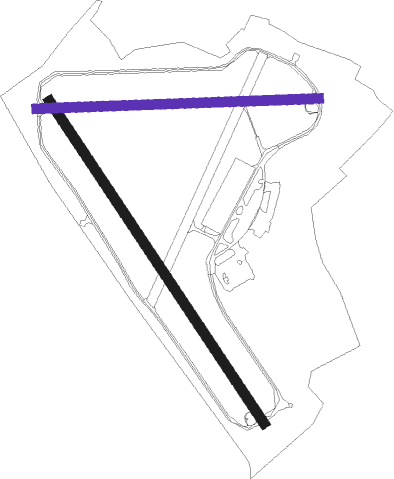
Runway info
Runway 15 / 33  | ||
| length | 1859m (6099ft) | |
| bearing | 136° / 316° | |
| width | 48m (156ft) | |
| surface | asphalt | |
| displ threshold | 224m (735ft) / 77m (253ft) | |
| Runway 10 / 28 | ||
| length | 1356m (4449ft) | |
| bearing | 91° / 271° | |
| width | 46m (151ft) | |
| surface | asphalt | |
| displ threshold | 425m (1394ft) / 0m (0ft) | |
Nearby beacons
| code | identifier | dist | bearing | frequency |
|---|---|---|---|---|
| LEE | LEEMING TACAN | 10.4 | 323° | 112.60 |
| LBA | LEEDS BRADFORD NDB | 18.3 | 221° | 402 |
| SBL | SHERBURN-IN-ELMET NDB | 22.2 | 149° | 323 |
| TD | TEESSIDE INTL NDB | 25.5 | 11° | 347 |
| POL | POLE HILL VOR/DME | 33.8 | 240° | 112.10 |
| FNY | DONCASTER SHEFFIELD NDB | 42.4 | 148° | 338 |
| GAM | GAMSTON VOR/DME | 54.1 | 151° | 112.80 |
| NEW | DME | 54.9 | 343° | 114.25 |
| NT | NEWCASTLE NDB | 55.3 | 346° | 352 |
| MCT | MANCHESTER VOR/DME | 55.6 | 227° | 113.55 |
| WAD | WADDINGTON TACAN | 66.4 | 138° | 117.10 |
Disclaimer
The information on this website is not for real aviation. Use this data with the X-Plane flight simulator only! Data taken with kind consent from X-Plane 12 source code and data files. Content is subject to change without notice.