Wittering - Raf Witerring
Airport details
| Country | United Kingdom |
| State | England |
| Region | EG |
| Airspace | London Ctr |
| Municipality | Wittering |
| Elevation | 271ft (83m) |
| Timezone | GMT +0 |
| Coordinates | 52.61177, -0.46964 |
| Magnetic var | |
| Type | land |
| Available since | X-Plane v10.40 |
| ICAO code | EGXT |
| IATA code | n/a |
| FAA code | n/a |
Communication
| RAF Witerring Wittering Tower | 125.525 |
| RAF Witerring Wittering Approach | 130.200 |
Nearby Points of Interest:
Kings Mill
-Stamford Town Hall
-Browne's Hospital
-Wansford Pasture
-Southorpe Meadow
-St Leonard's Priory, Stamford
-St Paul's Church, Stamford
-Southorpe Paddock
-Ufford Hall
-Walcot Hall
-RAF North Luffenham
-Woodcroft Castle
-Elton Hall
-Milton Hall
-Town Hall
-Deene Park
-Oundle railway station
-Holywell Hall
-Thorpe Hall
-Old Guild Hall
-Peterscourt
-Barnwell Castle
-Barnwell Manor
-St Mary the Virgin's Church, Ayston
-Lyveden New Bield
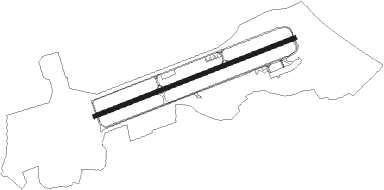
Runway info
| Runway 08 / 26 | ||
| length | 2751m (9026ft) | |
| bearing | 80° / 260° | |
| width | 57m (186ft) | |
| surface | asphalt | |
Nearby beacons
| code | identifier | dist | bearing | frequency |
|---|---|---|---|---|
| WIT | WITTERING TACAN | 1 | 262° | 117.60 |
| LE | LEICESTER NDB | 20.6 | 269° | 383 |
| CWL | CRANWELL NDB | 24.9 | 357° | 423 |
| CWZ | CRANWELL TACAN | 25 | 358° | 117.40 |
| CIT | CRANFIELD NDB | 29.1 | 190° | 850 |
| EME | EAST MIDLANDS NDB | 29.5 | 287° | 353 |
| CGY | CONINGSBY TACAN | 30.7 | 32° | 111.10 |
| WAD | WADDINGTON TACAN | 33.3 | 354° | 117.10 |
| CAM | CAMBRIDGE NDB | 33.9 | 122° | 332 |
| DTY | DAVENTRY VOR/DME | 35 | 236° | 116.40 |
| MAM | MARHAM TACAN | 37.6 | 88° | 108.70 |
| MLD | MILDENHALL TACAN | 38 | 105° | 115.90 |
| EMW | EAST MIDLANDS NDB | 38.1 | 282° | 393 |
| LKH | LAKENHEATH TACAN | 39.1 | 101° | 110.20 |
| BKY | BARKWAY VOR/DME | 42.1 | 139° | 116.25 |
| GAM | GAMSTON VOR/DME | 43.7 | 325° | 112.80 |
| LUT | LUTON NDB | 43.8 | 163° | 345 |
| WCO | WESTCOTT NDB | 49 | 213° | 335 |
| HEN | HENTON NDB | 52.5 | 201° | 433 |
| BNN | BOVINGDON VOR/DME | 53.2 | 185° | 113.75 |
| BPK | BROOKMANS PARK VOR/DME | 53.4 | 157° | 117.50 |
| FNY | DONCASTER SHEFFIELD NDB | 55.2 | 328° | 338 |
| OX | OXFORD NDB | 56.3 | 228° | 367 |
| KIM | HUMBERSIDE NDB | 57.9 | 7° | 365 |
| CHT | CHILTERN NDB | 59.4 | 183° | 277 |
| WTZ | WATTISHAM TACAN | 59.4 | 109° | 109.30 |
| LAM | LAMBOURNE VOR/DME | 62.3 | 147° | 115.60 |
| BSO | BENSON TACAN | 64.2 | 212° | 110 |
| NWI | NORWICH NDB | 64.2 | 88° | 342 |
Disclaimer
The information on this website is not for real aviation. Use this data with the X-Plane flight simulator only! Data taken with kind consent from X-Plane 12 source code and data files. Content is subject to change without notice.