Newark - Raf Syerston
Airport details
| Country | United Kingdom |
| State | England |
| Region | EG |
| Airspace | London Ctr |
| Municipality | Rushcliffe |
| Elevation | 228ft (69m) |
| Timezone | GMT +0 |
| Coordinates | 53.02332, -0.91164 |
| Magnetic var | |
| Type | land |
| Available since | X-Plane v10.40 |
| ICAO code | EGXY |
| IATA code | n/a |
| FAA code | n/a |
Communication
| RAF Syerston Syerston Radio | 125.425 |
Nearby Points of Interest:
Stoke Hall
-All Saints' Church, Hawton
-Upton Hall
-Town Hall
-School of Violin Making
-Wiverton Hall
-Mary Hardstaff Homes
-Langar Hall
-Langford Hall
-Sir John Robinson's Almshouses
-All Saints' Church
-St Alban's Church, Sneinton
-Albion Congregational Church
-Woodborough Road Baptist Church
-Oldknows Factory
-Plumptre Hospital
-St Mary's School
-St Hugh's College, Tollerton
-County House
-Norris Almshouses
-Nottingham Guildhall
-Nottingham Council House
-Elite Building
-Caves at Drury Hill
-Flying Horse Inn
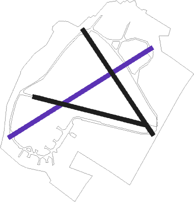
Runway info
| Runway 06 / 24 | ||
| length | 1806m (5925ft) | |
| bearing | 73° / 253° | |
| width | 46m (151ft) | |
| surface | asphalt | |
Runway 15 / 33  | ||
| length | 1350m (4429ft) | |
| bearing | 137° / 317° | |
| width | 46m (151ft) | |
| surface | asphalt | |
| displ threshold | 211m (692ft) / 0m (0ft) | |
| Runway 11 / 29 | ||
| length | 1245m (4085ft) | |
| bearing | 101° / 281° | |
| width | 46m (151ft) | |
| surface | asphalt | |
Nearby beacons
| code | identifier | dist | bearing | frequency |
|---|---|---|---|---|
| CWL | CRANWELL NDB | 15.2 | 90° | 423 |
| CWZ | CRANWELL TACAN | 15.3 | 89° | 117.40 |
| EME | EAST MIDLANDS NDB | 15.3 | 236° | 353 |
| GAM | GAMSTON VOR/DME | 15.5 | 352° | 112.80 |
| WAD | WADDINGTON TACAN | 16.2 | 70° | 117.10 |
| EMW | EAST MIDLANDS NDB | 22.8 | 250° | 393 |
| LE | LEICESTER NDB | 25.4 | 196° | 383 |
| CGY | CONINGSBY TACAN | 27.1 | 85° | 111.10 |
| FNY | DONCASTER SHEFFIELD NDB | 27.3 | 349° | 338 |
| TNT | TRENT VOR/DME | 27.4 | 272° | 115.70 |
| WIT | WITTERING TACAN | 29.1 | 135° | 117.60 |
| TNL | TATENHILL NDB | 33.4 | 256° | 327 |
| KIM | HUMBERSIDE NDB | 38.6 | 45° | 365 |
| BHX | BIRMINGHAM NDB | 45.8 | 236° | 406 |
| SBL | SHERBURN-IN-ELMET NDB | 47.2 | 339° | 323 |
| HON | HONILEY VOR/DME | 48.5 | 228° | 113.65 |
| OTR | OTTRINGHAM VOR/DME | 49.8 | 50° | 113.90 |
| DTY | DAVENTRY VOR/DME | 51.1 | 193° | 116.40 |
| CIT | CRANFIELD NDB | 55.1 | 158° | 850 |
| LBA | LEEDS BRADFORD NDB | 57 | 319° | 402 |
| MAM | MARHAM TACAN | 58 | 104° | 108.70 |
| CAM | CAMBRIDGE NDB | 63 | 127° | 332 |
| MLD | MILDENHALL TACAN | 64.5 | 115° | 115.90 |
| LKH | LAKENHEATH TACAN | 64.7 | 113° | 110.20 |
Disclaimer
The information on this website is not for real aviation. Use this data with the X-Plane flight simulator only! Data taken with kind consent from X-Plane 12 source code and data files. Content is subject to change without notice.