Cranwell - Raf Cranwell
Airport details
| Country | United Kingdom |
| State | England |
| Region | EG |
| Airspace | London Ctr |
| Municipality | North Kesteven |
| Elevation | 217ft (66m) |
| Timezone | GMT +0 |
| Coordinates | 53.02973, -0.49275 |
| Magnetic var | |
| Type | land |
| Available since | X-Plane v10.40 |
| ICAO code | EGYD |
| IATA code | n/a |
| FAA code | n/a |
Communication
| RAF Cranwell Cranwell Information | 135.675 |
| RAF Cranwell Cranwell Departure | 122.100 |
| RAF Cranwell Cranwell Tower | 125.050 |
| RAF Cranwell Cranwell Approach | 119.375 |
| RAF Cranwell Cranwell Departure | 119.375 |
Approach frequencies
| ILS-cat-I | RW26 | 108.5 | 18.00mi |
| 3° GS | RW26 | 108.5 | 18.00mi |
Nearby Points of Interest:
Royal Air Force College Cranwell
-Westholme House
-Playhouse, Sleaford
-Sleaford Castle
-Leadenham House
-St Nicholas' Church, Normanton
-Cogglesford Mill
-Bass Maltings, Sleaford
-Culverthorpe Hall
-Boathouse at Belton House
-Metheringham Windmill
-Car Dyke
-Harrowby Hall
-Stow Fair, Lincolnshire
-Finkin Street Methodist Church
-The Guildhall and Sessions Hall
-Sempringham Priory
-Dogdyke Engine
-Langford Hall
-School of Violin Making
-Town Hall
-Lincoln St. Marks railway station
-Dowsby Hall
-All Saints' Church, Hawton
-All Saints' Church, Lincoln
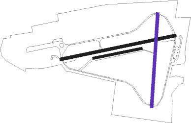
Runway info
Runway 08 / 26  | ||
| length | 1820m (5971ft) | |
| bearing | 86° / 266° | |
| width | 45m (148ft) | |
| surface | asphalt | |
| blast zone | 189m (620ft) / 107m (351ft) | |
| Runway 01 / 19 | ||
| length | 1460m (4790ft) | |
| bearing | 13° / 193° | |
| width | 45m (148ft) | |
| surface | asphalt | |
| blast zone | 26m (85ft) / 26m (85ft) | |
| Runway 09R / 27L | ||
| length | 759m (2490ft) | |
| bearing | 86° / 266° | |
| width | 40m (131ft) | |
| surface | grass | |
Nearby beacons
| code | identifier | dist | bearing | frequency |
|---|---|---|---|---|
| CWL | CRANWELL NDB | 0.2 | 133° | 423 |
| CWZ | CRANWELL TACAN | 0.2 | 98° | 117.40 |
| WAD | WADDINGTON TACAN | 8.2 | 346° | 117.10 |
| CGY | CONINGSBY TACAN | 12.2 | 79° | 111.10 |
| GAM | GAMSTON VOR/DME | 22.2 | 299° | 112.80 |
| WIT | WITTERING TACAN | 25.3 | 181° | 117.60 |
| EME | EAST MIDLANDS NDB | 28 | 254° | 353 |
| LE | LEICESTER NDB | 32.1 | 232° | 383 |
| FNY | DONCASTER SHEFFIELD NDB | 32.3 | 311° | 338 |
| KIM | HUMBERSIDE NDB | 33 | 14° | 365 |
| EMW | EAST MIDLANDS NDB | 36.8 | 258° | 393 |
| OTR | OTTRINGHAM VOR/DME | 42.4 | 30° | 113.90 |
| MAM | MARHAM TACAN | 44.6 | 110° | 108.70 |
| SBL | SHERBURN-IN-ELMET NDB | 52.3 | 317° | 323 |
| LKH | LAKENHEATH TACAN | 53.2 | 121° | 110.20 |
| MLD | MILDENHALL TACAN | 53.6 | 124° | 115.90 |
| CIT | CRANFIELD NDB | 54 | 184° | 850 |
| CAM | CAMBRIDGE NDB | 55 | 140° | 332 |
| DTY | DAVENTRY VOR/DME | 55.8 | 216° | 116.40 |
| NWI | NORWICH NDB | 68 | 101° | 342 |
Departure and arrival routes
| Transition altitude | 3000ft |
| SID end points | distance | outbound heading | |
|---|---|---|---|
| RW26 | |||
| MID1C | 42mi | 30° | |
| MID1A | 22mi | 299° | |
Disclaimer
The information on this website is not for real aviation. Use this data with the X-Plane flight simulator only! Data taken with kind consent from X-Plane 12 source code and data files. Content is subject to change without notice.