Marham - Raf Marham
Airport details
| Country | United Kingdom |
| State | England |
| Region | EG |
| Airspace | London Ctr |
| Municipality | King's Lynn and West Norfolk |
| Elevation | 75ft (23m) |
| Timezone | GMT +0 |
| Coordinates | 52.64354, 0.55365 |
| Magnetic var | |
| Type | land |
| Available since | X-Plane v10.40 |
| ICAO code | EGYM |
| IATA code | KNF |
| FAA code | n/a |
Communication
| RAF Marham Marham Tower VHF | 118.325 |
| RAF Marham Marham Approach VHF | 124.150 |
Approach frequencies
| ILS-cat-I | RW24 | 110.75 | 18.00mi |
| 3° GS | RW24 | 110.75 | 18.00mi |
Nearby Points of Interest:
Marham Abbey
-Pentney Priory
-Winnold House
-West Acre Priory
-Crimplesham Hall
-Gayton Hall
-Gayton Windmill
-Middleton Tower
-Ryston Hall
-West Winch Windmill
-Guildhall
-Thoresby College
-Clifton House
-Merton Hall
-Anmer Hall
-Wolferton railway station
-Houghton Hall
-Raynham Hall
-Coxford Priory
-Letton Hall
-Ingleborough Tower Windmill
-East Wretham Heath
-Old Town Hall
-Crosskeys Bridge
-East Dereham Windmill
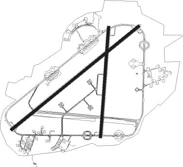
Runway info
Runway 06 / 24  | ||
| length | 2768m (9081ft) | |
| bearing | 67° / 247° | |
| width | 45m (148ft) | |
| surface | asphalt | |
| Runway 01 / 19 | ||
| length | 1859m (6099ft) | |
| bearing | 14° / 194° | |
| width | 45m (148ft) | |
| surface | asphalt | |
| displ threshold | 0m (0ft) / 65m (213ft) | |
Nearby beacons
| code | identifier | dist | bearing | frequency |
|---|---|---|---|---|
| MAM | MARHAM TACAN | 0.3 | 65° | 108.70 |
| LKH | LAKENHEATH TACAN | 14.2 | 181° | 110.20 |
| MLD | MILDENHALL TACAN | 16.9 | 193° | 115.90 |
| NWI | NORWICH NDB | 26.9 | 87° | 342 |
| CAM | CAMBRIDGE NDB | 29.3 | 221° | 332 |
| WTZ | WATTISHAM TACAN | 34.3 | 143° | 109.30 |
| CGY | CONINGSBY TACAN | 37.5 | 302° | 111.10 |
| WIT | WITTERING TACAN | 38.4 | 268° | 117.60 |
| BKY | BARKWAY VOR/DME | 43.2 | 217° | 116.25 |
| CWL | CRANWELL NDB | 44.2 | 290° | 423 |
| CWZ | CRANWELL TACAN | 44.2 | 290° | 117.40 |
| WAD | WADDINGTON TACAN | 50.1 | 296° | 117.10 |
| CIT | CRANFIELD NDB | 51 | 245° | 850 |
| CLN | CLACTON VOR/DME | 52.5 | 143° | 114.55 |
| LUT | LUTON NDB | 53.8 | 227° | 345 |
| LE | LEICESTER NDB | 57.9 | 269° | 383 |
| BPK | BROOKMANS PARK VOR/DME | 58.9 | 216° | 117.50 |
| LAM | LAMBOURNE VOR/DME | 61.7 | 202° | 115.60 |
| EME | EAST MIDLANDS NDB | 64.5 | 276° | 353 |
| KIM | HUMBERSIDE NDB | 64.7 | 316° | 365 |
| GAM | GAMSTON VOR/DME | 66.4 | 293° | 112.80 |
| DTY | DAVENTRY VOR/DME | 67.1 | 254° | 116.40 |
| BNN | BOVINGDON VOR/DME | 68.4 | 230° | 113.75 |
| HEN | HENTON NDB | 72.5 | 237° | 433 |
| WCO | WESTCOTT NDB | 73.2 | 242° | 335 |
| EMW | EAST MIDLANDS NDB | 73.8 | 275° | 393 |
Disclaimer
The information on this website is not for real aviation. Use this data with the X-Plane flight simulator only! Data taken with kind consent from X-Plane 12 source code and data files. Content is subject to change without notice.