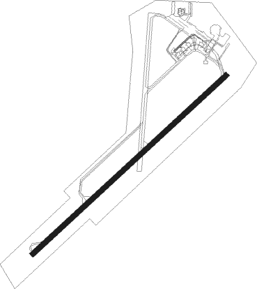
Groningen - Eelde
Airport details
| Country | Netherlands |
| State | Drenthe |
| Region | EH |
| Airspace | Amsterdam Ctr |
| Municipality | Eelde |
| Elevation | 17ft (5m) |
| Timezone | GMT +1 |
| Coordinates | 53.12500, 6.58333 |
| Magnetic var | |
| Type | land |
| Available since | X-Plane v10.40 |
| ICAO code | EHGG |
| IATA code | GRQ |
| FAA code | n/a |
Communication
| Eelde ATIS | 133.555 |
| Eelde DEL | 121.705 |
| Eelde Tower | 118.705 |
| Eelde Approach | 120.305 |
Approach frequencies
| ILS-cat-I | RW23 | 109.9 | 18.00mi |
| 3° GS | RW23 | 109.9 | 18.00mi |
Nearby beacons
| code | identifier | dist | bearing | frequency |
|---|---|---|---|---|
| EEL | EELDE (GRONINGEN) VOR/DME | 3.8 | 65° | 112.40 |
| LWD | LEEUWARDEN TACAN | 30.5 | 277° | 114.70 |
| RKN | DME | 59.9 | 170° | 116.80 |
Departure and arrival routes
| Transition altitude | 3000ft |
| SID end points | distance | outbound heading | |
|---|---|---|---|
| RW05 | |||
| TEML2C | 23mi | 39° | |
| OLWO1C | 21mi | 53° | |
| DOBA2C | 23mi | 82° | |
| SONE4C | 66mi | 171° | |
| TEBR4C | 74mi | 180° | |
| NAPR3C | 79mi | 202° | |
| RUME4C | 94mi | 205° | |
| ROLD4C | 20mi | 238° | |
| NOVE3C | 52mi | 239° | |
| PAM4C | 72mi | 242° | |
| SPY4C | 72mi | 251° | |
| ENKO4C | 55mi | 252° | |
| RW23 | |||
| TEML3D | 23mi | 39° | |
| OLWO1D | 21mi | 53° | |
| DOBA3D | 23mi | 82° | |
| SONE3D | 66mi | 171° | |
| TEBR3D | 74mi | 180° | |
| NAPR2D | 79mi | 202° | |
| RUME3D | 94mi | 205° | |
| ROLD2D | 20mi | 238° | |
| NOVE2D | 52mi | 239° | |
| PAM3D | 72mi | 242° | |
| SPY2D | 72mi | 251° | |
| ENKO2D | 55mi | 252° | |
| STAR starting points | distance | inbound heading | |
|---|---|---|---|
| ALL | |||
| TENL2G | 15.2 | 42° | |
| OSTI2G | 18.8 | 58° | |
| GRON2G | 19.0 | 88° | |
| TEML2G | 23.2 | 219° | |
| OLWO1G | 21.0 | 233° | |
| KUBA2G | 19.4 | 243° | |
| DOBA2G | 23.4 | 262° | |
| RKN2G | 59.9 | 350° | |
Instrument approach procedures
| runway | airway (heading) | route (dist, bearing) |
|---|---|---|
| RW05 | AMREG (78°) | AMREG 3000ft TUVOX (4mi, 127°) 2000ft |
| RW05 | VEXAR (46°) | VEXAR 3000ft TUVOX (4mi, 308°) 2000ft |
| RNAV | TUVOX 2000ft GG509 (4mi, 65°) 2000ft BANDU (2mi, 65°) 1340ft EHGG (5mi, 63°) 63ft GG751 (11mi, 65°) 2000ft | |
| RW23 | IDAKA (260°) | IDAKA 3000ft SIPLO (4mi, 307°) 2000ft |
| RW23 | XOMBI (225°) | XOMBI 3000ft SIPLO (4mi, 127°) 2000ft |
| RNAV | SIPLO 2000ft GG512 (4mi, 245°) 2000ft LARBO (2mi, 245°) 1340ft EHGG (4mi, 246°) 63ft GG752 (12mi, 244°) 2000ft |
Holding patterns
| STAR name | hold at | type | turn | heading* | altitude | leg | speed limit |
|---|---|---|---|---|---|---|---|
| DOBA2G | HECTI | VHF | right | 52 (232)° | > 2000ft | 1.0min timed | 220 |
| GRON2G | HECTI | VHF | right | 52 (232)° | > 2000ft | 1.0min timed | 220 |
| KUBA2G | HECTI | VHF | right | 52 (232)° | > 2000ft | 1.0min timed | 220 |
| OLWO1G | HECTI | VHF | right | 52 (232)° | > 2000ft | 1.0min timed | 220 |
| OSTI2G | HECTI | VHF | right | 52 (232)° | > 2000ft | 1.0min timed | 220 |
| RKN2G | HECTI | VHF | right | 52 (232)° | > 2000ft | 1.0min timed | 220 |
| TEML2G | HECTI | VHF | right | 52 (232)° | > 2000ft | 1.0min timed | 220 |
| TENL2G | HECTI | VHF | right | 52 (232)° | > 2000ft | 1.0min timed | 220 |
| *) magnetic outbound (inbound) holding course | |||||||
Disclaimer
The information on this website is not for real aviation. Use this data with the X-Plane flight simulator only! Data taken with kind consent from X-Plane 12 source code and data files. Content is subject to change without notice.
