Noordwijkerhout - Langeveld
Airport details
| Country | Netherlands |
| State | South Holland |
| Region | |
| Airspace | Amsterdam Ctr |
| Municipality | Noordwijk |
| Elevation | 132ft (40m) |
| Timezone | GMT +1 |
| Coordinates | 52.29761, 4.50556 |
| Magnetic var | |
| Type | land |
| Available since | X-Plane v10.40 |
| ICAO code | EHLV |
| IATA code | n/a |
| FAA code | n/a |
Communication
Nearby Points of Interest:
Station Lisse
-Sint Bavo
-Raadhuis, Noordwijkerhout
-Oude pomp
-Gemeentehuis Hillegom
-Watertoren, Hillegom
-Huis te Vogelenzang: hoofdonderdeel
-Onze Lieve Vrouw ten Hemelopnemingkerk, Vogelenzang
-Sint-Agathaklooster
-Nieuw Zomerzorg
-Hoeve Wassergeest
-Watertoren Bennebroek
-Station Vogelenzang-Bennebroek
-Vakantiehuis De Vonk
-Hervormde Kerk, Bennebroek
-Hartekamp
-Bust of Linnaeus, Hartekamp
-Gedenkteken
-Obelisk
-Noordhout
-Calorama
-Huis te Manpad
-Kapel aan Zee
-Voorstraat 47, Noordwijk
-Weeshuispoortje (Noordwijk)
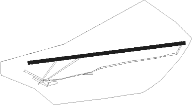
Runway info
| Runway 06 / 24 | ||
| length | 892m (2927ft) | |
| bearing | 88° / 268° | |
| width | 19m (62ft) | |
| surface | dirt | |
Nearby beacons
| code | identifier | dist | bearing | frequency |
|---|---|---|---|---|
| AMS | DME | 7.6 | 80° | 113.95 |
| SPL | SCHIPHOL (AMSTERDAM) VOR/DME | 9.2 | 82° | 108.40 |
| SPY | DME | 19.3 | 55° | 113.30 |
| RTM | ROTTERDAM VOR/DME | 19.4 | 184° | 110.40 |
| FRT | DME | 20.1 | 138° | 117.15 |
| PAM | PAMPUS VOR/DME | 21.6 | 86° | 117.80 |
| HDR | HELDER DME | 37.8 | 23° | 115.55 |
| GZR | GILZE-RIJEN TACAN | 46.7 | 150° | 116.40 |
| WDT | WOENSDRECHT TACAN | 51.4 | 191° | 115 |
| EHV | EINDHOVEN TACAN | 60.3 | 134° | 117.20 |
Disclaimer
The information on this website is not for real aviation. Use this data with the X-Plane flight simulator only! Data taken with kind consent from X-Plane 12 source code and data files. Content is subject to change without notice.