Leeuwarden
Airport details
| Country | Netherlands |
| State | Frisia |
| Region | EH |
| Airspace | Amsterdam Ctr |
| Municipality | Leeuwarden |
| Elevation | 1ft (0m) |
| Timezone | GMT +1 |
| Coordinates | 53.22533, 5.75250 |
| Magnetic var | |
| Type | land |
| Available since | X-Plane v10.40 |
| ICAO code | EHLW |
| IATA code | LWR |
| FAA code | n/a |
Communication
| Leeuwarden Tower | 122.100 |
| Leeuwarden Tower | 120.700 |
| Leeuwarden RAPCON NORTH | 122.100 |
| Leeuwarden ARRIVAL | 122.100 |
Approach frequencies
| ILS-cat-I | RW27 | 109.75 | 18.00mi |
| ILS-cat-I | RW23 | 111.75 | 18.00mi |
| ILS-cat-I | RW05 | 111.75 | 18.00mi |
| ILS-cat-I | RW09 | 109.75 | 18.00mi |
| 3° GS | RW27 | 109.75 | 18.00mi |
| 3° GS | RW23 | 111.75 | 18.00mi |
| 3° GS | RW05 | 111.75 | 18.00mi |
| 3° GS | RW09 | 109.75 | 18.00mi |
Nearby Points of Interest:
Poptagasthuis
-De Kleine Molen
-Diaconessenhuis, Leeuwarden
-Harlingersingel 2, Leeuwarden
-Burmaniahuis
-Coulonhûs (Leeuwarden)
-Noorderbrug
-Nieuw Sint Anthonygasthuis
-Grytmanshûs
-Boshuisengasthuis
-Nieuwe Manege, Leeuwarden
-Oud Sint Anthonygasthuis, Leeuwarden
-Westerkerk
-Keimpemastins
-Stadhouderlijk Hof
-Paleis van Justitie
-Leeuwarden City Hall
-Synagoge
-Sint Jacobsstraat 13, Leeuwarden
-Waag
-Centraal Apotheek
-Kanselarij
-Provinciehuis Leeuwarden
-Beursgebouw
-Hoofdpostkantoor (Leeuwarden)
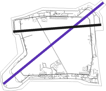
Runway info
| Runway 05 / 23 | ||
| length | 2937m (9636ft) | |
| bearing | 68° / 248° | |
| width | 50m (164ft) | |
| surface | asphalt | |
| displ threshold | 241m (791ft) / 306m (1004ft) | |
Runway 09 / 27  | ||
| length | 1997m (6552ft) | |
| bearing | 90° / 270° | |
| width | 50m (164ft) | |
| surface | asphalt | |
| displ threshold | 59m (194ft) / 0m (0ft) | |
Nearby beacons
| code | identifier | dist | bearing | frequency |
|---|---|---|---|---|
| LWD | LEEUWARDEN TACAN | 0.1 | 201° | 114.70 |
| EEL | EELDE (GRONINGEN) VOR/DME | 33 | 94° | 112.40 |
| HDR | HELDER DME | 40.4 | 252° | 115.55 |
| FRO | DME | 47.2 | 198° | 111.40 |
| SPY | DME | 52.4 | 233° | 113.30 |
| PAM | PAMPUS VOR/DME | 58.6 | 217° | 117.80 |
Instrument approach procedures
| runway | airway (heading) | route (dist, bearing) |
|---|---|---|
| RW05-Z | LW414 (67°) | LW414 2000ft LW413 (5mi, 67°) 2000ft |
| RW05-Z | LW415 (82°) | LW415 2000ft LW413 (5mi, 113°) 2000ft |
| RW05-Z | LW416 (49°) | LW416 2000ft LW413 (5mi, 336°) 2000ft |
| RNAV | LW413 2000ft LW412 (4mi, 67°) 2000ft EHLW (7mi, 67°) 54ft (3210mi, 186°) 1200ft (turn) 3000ft LW415 (3205mi, 6°) | |
| RW23-Z | LW404 (248°) | LW404 2000ft LW403 (5mi, 248°) 2000ft |
| RW23-Z | LW405 (229°) | LW405 2000ft LW403 (5mi, 157°) 2000ft |
| RW23-Z | LW406 (262°) | LW406 2000ft LW403 (5mi, 293°) 2000ft |
| RNAV | LW403 2000ft LW402 (4mi, 248°) 2000ft EHLW (7mi, 248°) 54ft (3210mi, 186°) 1200ft (turn) 3000ft LW405 (3221mi, 6°) |
Disclaimer
The information on this website is not for real aviation. Use this data with the X-Plane flight simulator only! Data taken with kind consent from X-Plane 12 source code and data files. Content is subject to change without notice.