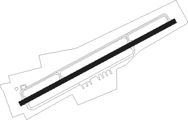
Hoeven - Breda International Airport - Seppe
Airport details
| Country | Netherlands |
| State | North Brabant |
| Region | EH |
| Airspace | Amsterdam Ctr |
| Municipality | Bosschenhoofd |
| Elevation | 28ft (9m) |
| Timezone | GMT +1 |
| Coordinates | 51.55472, 4.55250 |
| Magnetic var | |
| Type | land |
| Available since | X-Plane v10.40 |
| ICAO code | EHSE |
| IATA code | n/a |
| FAA code | n/a |
Communication
| Breda International Airport - Seppe Seppe Radio | 120.650 |
Runway info
| Runway 07 / 25 | ||
| length | 857m (2812ft) | |
| bearing | 75° / 255° | |
| width | 23m (75ft) | |
| surface | asphalt | |
| displ threshold | 78m (256ft) / 76m (249ft) | |
Nearby beacons
| code | identifier | dist | bearing | frequency |
|---|---|---|---|---|
| WDT | WOENSDRECHT TACAN | 10.1 | 243° | 115 |
| GZR | GILZE-RIJEN TACAN | 14.2 | 88° | 116.40 |
| ANT | ANTWERP (DEURNE) VOR/DME | 22 | 192° | 113.50 |
| ONW | ANTWERP NDB | 23.2 | 178° | 355 |
| RTM | ROTTERDAM VOR/DME | 25.3 | 350° | 110.40 |
| NIK | NICKY VOR/DME | 27.1 | 223° | 117.40 |
| FRT | DME | 28.1 | 26° | 117.15 |
| BUN | BRUNO VOR/DME | 28.3 | 146° | 110.60 |
| EHV | EINDHOVEN TACAN | 31.4 | 97° | 117.20 |
| OP | BRUSSELS NATIONAL NDB | 37 | 176° | 402 |
| OB | BRUSSELS NDB | 38.1 | 174° | 293 |
| BUB | BRUSSELS VOR/DME | 39.1 | 181° | 114.60 |
| BBL | KLEINE BROGEL TACAN | 41.3 | 113° | 109.60 |
| AFI | AFFLIGEM VOR/DME | 41.8 | 213° | 114.90 |
| OZ | BRUSSELS NATIONAL NDB | 43.8 | 187° | 314 |
| FLO | FLORA VOR/DME | 46.2 | 139° | 112.05 |
| AMS | DME | 47 | 11° | 113.95 |
| SPL | SCHIPHOL (AMSTERDAM) VOR/DME | 47.2 | 14° | 108.40 |
| HUL | HULDENBERG VOR/DME | 48.4 | 174° | 117.55 |
| BBE | BEAUVECHAIN TACAN | 48.6 | 165° | 116 |
| HTB | BEAUVECHAIN NDB | 48.6 | 165° | 381 |
| PAM | PAMPUS VOR/DME | 50.9 | 35° | 117.80 |
| SPY | DME | 60.2 | 17° | 113.30 |
| ONL | LIEGE NDB | 63.5 | 131° | 290 |
| LGE | LIEGE VOR/DME | 64.2 | 134° | 115.45 |
| FRO | DME | 64.4 | 47° | 111.40 |
| CIV | CHIEVRES VORTAC | 64.8 | 216° | 113.20 |
Disclaimer
The information on this website is not for real aviation. Use this data with the X-Plane flight simulator only! Data taken with kind consent from X-Plane 12 source code and data files. Content is subject to change without notice.
