Airports for X-Plane offers a convenient way to explore airports and their related communication information for the X-Plane flight simulator. It only uses data from the X-Plane flight simulator itself, and is therefore more reliable than the data that comes from real aviation websites. You can search for airports by using the ICAO code, or browse for airports per country and state. The information displayed is categorized by airport details, runway information, airport communication, approach frequencies (ILS and Glidepath details), details of nearby beacons, SIDs, STARs and approach procedures.

embassy runway automated airport weather station local government arriving port arrival rail transport airport check-in helipad ferry runway lighting hospital airport authority concrete landing area hangar station stolport flights

Stadskanaal

Airport details

CountryNetherlands
StateGroningen
RegionEH
AirspaceAmsterdam Ctr
MunicipalityStadskanaal
Elevation14ft (4m)
TimezoneGMT +1
Coordinates52.99861, 7.02278
Magnetic var
Typeland
Available sinceX-Plane v10.40
ICAO codeEHST
IATA coden/a
FAA coden/a

Communication

Stadskanaal Stadskanaal information123.425
Stadskanaal Eelde Approach120.300
Nearby Points of Interest:
Dorpsstraat 1
-
Slachthuis met schuur
-
Huize Ter Marse
-
Oosterkadekerk
-
3e Verlaat
-
brugwachtershuisje
-
Woningcomplex Oranjestraat
-
't Hofje
-
Julianapark, Stadskanaal
-
4e Verlaat
-
De Beuk, Stadskanaal
-
Noorderdiep 542
-
Handelsstraat 59
-
Handelsstraat 58
-
Burgemeester Lieseschool
-
Villa Flora, Nieuw-Buinen
-
Noorderdiep 115, Nieuw-Buinen
-
5e Verlaat
-
2e Verlaat
-
Zaalkerk
-
Hervormde Kerk
-
Zuiderdiep 385
-
Scheepswerfstraat 38, Stadskanaal
-
Kerk van Wedde
-
1e Verlaat

Runway info

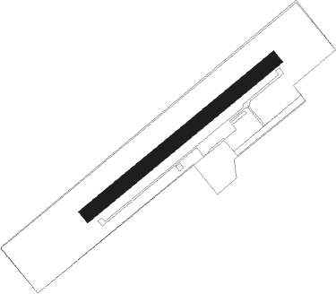
Runway 06 / 24
 length501m (1644ft)
 bearing67° / 247°
 width30m (98ft)
 surfacegrass

Airport layout


Nearby beacons

codeidentifierdistbearingfrequency
EELEELDE (GRONINGEN) VOR/DME16.2295°112.40
WTMWITTMUNDHAFEN TACAN41.852°113.50
RKNDME52.8197°116.80
MODDME57142°114.05
MYNMUENSTER/OSNABRUECK NDB57.8137°371

Disclaimer

The information on this website is not for real aviation. Use this data with the X-Plane flight simulator only! Data taken with kind consent from X-Plane 12 source code and data files. Content is subject to change without notice.