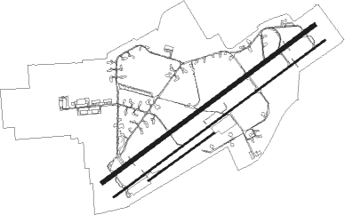
Uden - Volkel
Airport details
| Country | Netherlands |
| State | North Brabant |
| Region | EH |
| Airspace | Amsterdam Ctr |
| Municipality | Volkel |
| Elevation | 69ft (21m) |
| Timezone | GMT +1 |
| Coordinates | 51.65717, 5.70783 |
| Magnetic var | |
| Type | land |
| Available since | X-Plane v10.40 |
| ICAO code | EHVK |
| IATA code | n/a |
| FAA code | n/a |
Communication
| Volkel Dutch Mill | 132.350 |
| Volkel Volkel Tower | 136.075 |
| Volkel Volkel Arrival | 122.100 |
| Volkel Rapcon South | 123.175 |
Approach frequencies
| ILS-cat-I | RW24R | 110.75 | 18.00mi |
| ILS-cat-I | RW06L | 110.75 | 18.00mi |
| 3° GS | RW24R | 110.75 | 18.00mi |
| 3° GS | RW06L | 110.75 | 18.00mi |
Runway info
Nearby beacons
| code | identifier | dist | bearing | frequency |
|---|---|---|---|---|
| VKL | VOLKEL TACAN | 0.1 | 206° | 108.30 |
| NID | DME | 16.5 | 98° | 115.50 |
| EHV | EINDHOVEN TACAN | 17.6 | 238° | 117.20 |
| LAA | NIEDERRHEIN NDB | 17.6 | 97° | 352 |
| DLN | DEELEN TACAN | 24.7 | 22° | 112.20 |
| GZR | GILZE-RIJEN TACAN | 29.3 | 263° | 116.40 |
| BBL | KLEINE BROGEL TACAN | 30.7 | 206° | 109.60 |
| LMA | LIMA NDB | 30.9 | 113° | 311 |
| MHV | MOENCHENGLADBACH VOR | 38.6 | 118° | 109.80 |
| MHD | DME | 38.7 | 118° | 112.50 |
| NW | MAASTRICHT NDB | 38.8 | 165° | 373 |
| FRT | DME | 40.6 | 290° | 117.15 |
| MAS | MAASTRICHT VOR/DME | 42.2 | 160° | 108.60 |
| DY | DUESSELDORF NDB | 43.5 | 114° | 284 |
| GIX | GEILENKIRCHEN TACAN | 43.5 | 154° | 108.10 |
| BUN | BRUNO VOR/DME | 45.8 | 238° | 110.60 |
| PAM | PAMPUS VOR/DME | 46.6 | 318° | 117.80 |
| FRO | DME | 48.3 | 346° | 111.40 |
| FLO | FLORA VOR/DME | 51.5 | 216° | 112.05 |
| SPL | SCHIPHOL (AMSTERDAM) VOR/DME | 53.8 | 305° | 108.40 |
| ONL | LIEGE NDB | 57.7 | 189° | 290 |
| NVO | NOERVENICH VORTAC | 61 | 132° | 116.20 |
| WNN | DME | 61.1 | 131° | 109.85 |
| SPY | DME | 61.6 | 316° | 113.30 |
| BBE | BEAUVECHAIN TACAN | 64.5 | 226° | 116 |
| HTB | BEAUVECHAIN NDB | 64.6 | 226° | 381 |
Departure and arrival routes
| Transition altitude | 3000ft |
| SID end points | distance | outbound heading | |
|---|---|---|---|
| RW06 (ALL) | |||
| VK7 | 33mi | 316° | |
| RW24 (ALL) | |||
| VK5, VK6 | 33mi | 316° | |
Disclaimer
The information on this website is not for real aviation. Use this data with the X-Plane flight simulator only! Data taken with kind consent from X-Plane 12 source code and data files. Content is subject to change without notice.

