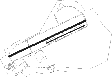
Bergen Op Zoom - Woensdrecht
Airport details
| Country | Netherlands |
| State | North Brabant |
| Region | EH |
| Airspace | Amsterdam Ctr |
| Municipality | Hoogerheide |
| Elevation | 62ft (19m) |
| Timezone | GMT +1 |
| Coordinates | 51.44900, 4.34217 |
| Magnetic var | |
| Type | land |
| Available since | X-Plane v10.40 |
| ICAO code | EHWO |
| IATA code | WOE |
| FAA code | n/a |
Communication
| Woensdrecht Tower | 118.500 |
| Woensdrecht ARRIVAL | 123.575 |
| Woensdrecht RAPCON WEST | 123.575 |
Approach frequencies
| ILS-cat-I | RW25 | 108.15 | 18.00mi |
| ILS-cat-I | RW07 | 108.15 | 18.00mi |
| 3° GS | RW25 | 108.15 | 18.00mi |
| 3° GS | RW07 | 108.15 | 18.00mi |
Nearby beacons
| code | identifier | dist | bearing | frequency |
|---|---|---|---|---|
| WDT | WOENSDRECHT TACAN | 0.1 | 132° | 115 |
| ANT | ANTWERP (DEURNE) VOR/DME | 16.2 | 153° | 113.50 |
| NIK | NICKY VOR/DME | 18 | 209° | 117.40 |
| ONW | ANTWERP NDB | 18.8 | 141° | 355 |
| GZR | GILZE-RIJEN TACAN | 23.1 | 79° | 116.40 |
| BUN | BRUNO VOR/DME | 27.3 | 123° | 110.60 |
| RTM | ROTTERDAM VOR/DME | 31.9 | 15° | 110.40 |
| OP | BRUSSELS NATIONAL NDB | 32 | 154° | 402 |
| AFI | AFFLIGEM VOR/DME | 33.3 | 201° | 114.90 |
| OB | BRUSSELS NDB | 33.3 | 153° | 293 |
| BUB | BRUSSELS VOR/DME | 33.6 | 160° | 114.60 |
| FRT | DME | 36.9 | 38° | 117.15 |
| COA | COSTA VOR/DME | 37.4 | 264° | 110.05 |
| OZ | BRUSSELS NATIONAL NDB | 37.6 | 169° | 314 |
| MAK | MACKEL NDB | 43.1 | 240° | 360 |
| HUL | HULDENBERG VOR/DME | 43.5 | 157° | 117.55 |
| BBE | BEAUVECHAIN TACAN | 44.5 | 148° | 116 |
| HTB | BEAUVECHAIN NDB | 44.6 | 149° | 381 |
| FLO | FLORA VOR/DME | 45.5 | 126° | 112.05 |
| AMS | DME | 54.7 | 22° | 113.95 |
| SPL | SCHIPHOL (AMSTERDAM) VOR/DME | 55.1 | 25° | 108.40 |
| CIV | CHIEVRES VORTAC | 55.9 | 210° | 113.20 |
| ONC | CHARLEROI NDB | 58.1 | 167° | 323 |
| GSY | GOSLY (CHARLEROI) VOR/DME | 59.8 | 174° | 115.70 |
| PAM | PAMPUS VOR/DME | 60 | 40° | 117.80 |
Departure and arrival routes
| Transition altitude | 3000ft |
| SID end points | distance | outbound heading | |
|---|---|---|---|
| RW07 | |||
| WO3 | 23mi | 79° | |
| RW25 | |||
| WO1 | 23mi | 79° | |
Disclaimer
The information on this website is not for real aviation. Use this data with the X-Plane flight simulator only! Data taken with kind consent from X-Plane 12 source code and data files. Content is subject to change without notice.

