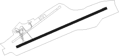
Killarney - Kerry
Airport details
| Country | Ireland |
| State | County Kerry |
| Region | EI |
| Airspace | Shannon Ctr |
| Municipality | Tralee Municipal District |
| Elevation | 105ft (32m) |
| Timezone | GMT +0 |
| Coordinates | 52.18088, -9.52378 |
| Magnetic var | |
| Type | land |
| Available since | X-Plane v10.40 |
| ICAO code | EIKY |
| IATA code | KIR |
| FAA code | n/a |
Communication
| Kerry Kerry Information | 118.025 |
| Kerry Kerry Ground | 121.600 |
| Kerry Kerry Tower | 123.325 |
Approach frequencies
| ILS-cat-I | RW26 | 108.7 | 18.00mi |
| 3.5° GS | RW26 | 108.7 | 18.00mi |
Nearby beacons
| code | identifier | dist | bearing | frequency |
|---|---|---|---|---|
| KER | KERRY NDB | 0 | 331° | 334 |
| FOY | FOYNES NDB | 26 | 40° | 395 |
| SHA | SHANNON VOR/DME | 39.9 | 50° | 113.30 |
| OL | SHANNON NDB | 42.6 | 51° | 339 |
Departure and arrival routes
| Transition altitude | 5000ft |
| SID end points | distance | outbound heading | |
|---|---|---|---|
| RW08 | |||
| SHA3C, SHA3D | 40mi | 50° | |
| CRK3C, CRK3D | 43mi | 108° | |
| RW26 | |||
| SHA3A, SHA3B | 40mi | 50° | |
| CRK3A, CRK3B | 43mi | 108° | |
Instrument approach procedures
| runway | airway (heading) | route (dist, bearing) |
|---|---|---|
| RW08 | BAKOT (88°) | BAKOT 3900ft DIMGO (3mi, 151°) 3400ft |
| RW08 | LOBGO (78°) | LOBGO 4500ft DIMGO (3mi, 78°) 3400ft |
| RW08 | NEMAK (67°) | NEMAK 4500ft DIMGO (3mi, 331°) 3400ft |
| RNAV | DIMGO 3400ft KEREX (6mi, 78°) 2000ft EIKY (6mi, 78°) 131ft KY022 (5mi, 78°) 4000ft KY023 (5mi, 331°) 4000ft BAKOT (17mi, 253°) 4000ft BAKOT (turn) | |
| RW26 | KY015 (259°) | KY015 3700ft INRAD (4mi, 259°) 3000ft ROTSO (6mi, 259°) 3000ft |
| RW26 | KY019 (246°) | KY019 3900ft INRAD (5mi, 152°) 3000ft ROTSO (6mi, 259°) 3000ft |
| RW26 | KY020 (269°) | KY020 4500ft INRAD (4mi, 332°) 3000ft ROTSO (6mi, 259°) 3000ft |
| RNAV | ROTSO 3000ft KY012 (3mi, 258°) 2020ft KY013 (2mi, 258°) 1280ft EIKY (4mi, 258°) 161ft KY018 (4mi, 259°) 3000ft KER (4mi, 78°) 3000ft KER (turn) 3000ft |
Disclaimer
The information on this website is not for real aviation. Use this data with the X-Plane flight simulator only! Data taken with kind consent from X-Plane 12 source code and data files. Content is subject to change without notice.
