Spanish Point
Airport details
| Country | Ireland |
| State | County Clare |
| Region | |
| Airspace | Shannon Ctr |
| Municipality | West Clare Municipal District |
| Elevation | 17ft (5m) |
| Timezone | GMT +0 |
| Coordinates | 52.84675, -9.41418 |
| Magnetic var | |
| Type | land |
| Available since | X-Plane v10.40 |
| ICAO code | EISP |
| IATA code | n/a |
| FAA code | n/a |
Communication
Nearby Points of Interest:
The Burren
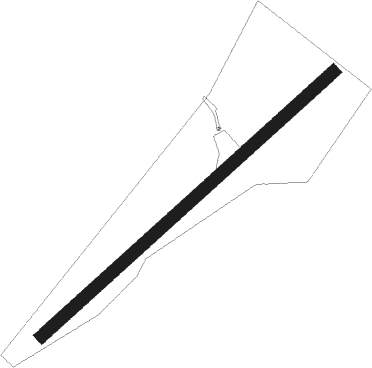
Runway info
| Runway 06 / 24 | ||
| length | 562m (1844ft) | |
| bearing | 65° / 245° | |
| width | 18m (59ft) | |
| surface | grass | |
Nearby beacons
| code | identifier | dist | bearing | frequency |
|---|---|---|---|---|
| FOY | FOYNES NDB | 18.6 | 142° | 395 |
| SHA | SHANNON VOR/DME | 20.6 | 103° | 113.30 |
| OL | SHANNON NDB | 22.2 | 99° | 339 |
| KER | KERRY NDB | 40.1 | 189° | 334 |
Disclaimer
The information on this website is not for real aviation. Use this data with the X-Plane flight simulator only! Data taken with kind consent from X-Plane 12 source code and data files. Content is subject to change without notice.