Stettler
Airport details
| Country | Canada |
| State | Alberta |
| Region | |
| Airspace | Edmonton Ctr |
| Municipality | County of Stettler |
| Elevation | 2686ft (819m) |
| Timezone | GMT -7 |
| Coordinates | 52.30996, -112.76107 |
| Magnetic var | |
| Type | land |
| Available since | X-Plane v10.40 |
| ICAO code | EJ3 |
| IATA code | n/a |
| FAA code | n/a |
Communication
| Stettler UNICOM / Traffic | 123.000 |
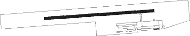
Runway info
| Runway 07 / 25 | ||
| length | 915m (3002ft) | |
| bearing | 90° / 270° | |
| width | 23m (75ft) | |
| surface | asphalt | |
Nearby beacons
| code | identifier | dist | bearing | frequency |
|---|---|---|---|---|
| D3 | PONOKA INDUS NDB | 38.1 | 294° | 363 |
| 2K | CAMROSE NDB | 43.4 | 356° | 405 |
| 9A | HANNA NDB | 51.8 | 128° | 221 |
| ZAB | LEDUC (EDMONTON) NDB | 61.9 | 322° | 215 |
| ZZD | CALMAR (EDMONTON) NDB | 65.4 | 316° | 308 |
Disclaimer
The information on this website is not for real aviation. Use this data with the X-Plane flight simulator only! Data taken with kind consent from X-Plane 12 source code and data files. Content is subject to change without notice.