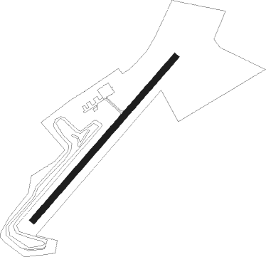
Kruså / Padborg - Krusa Padborg
Airport details
| Country | Denmark |
| State | Region of Southern Denmark |
| Region | EK |
| Airspace | Copenhagen Ctr |
| Municipality | Aabenraa Municipality |
| Elevation | 86ft (26m) |
| Timezone | GMT +1 |
| Coordinates | 54.87030, 9.27901 |
| Magnetic var | |
| Type | land |
| Available since | X-Plane v10.40 |
| ICAO code | EKPB |
| IATA code | n/a |
| FAA code | n/a |
Communication
| Krusa Padborg SKRYDSTRUP Approach | 127.475 |
Nearby Points of Interest:
Panzerkaserne
-Malteser Krankenhaus St. Franziskus-Hospital
-Hübsch-Speicher
-Kapitänshaus Sonwik
-Trampedachlager
-Naval Academy at Mürwik
-Gorch-Fock-Haus
-Bonte-Kaserne
-Eckener Haus
-Schrangen
-Kaufmannshaus Hansen
-Logenhaus
-St. Marien-Mädchenschule I
-Ehrenhain
-Burg Schöneck
-Fördestraße 1
-Mürwiker Strasse 183-185
-Hans-Christiansen-Haus
-Christuskirche
-Marineschule Mürwik Stabszug
-Westindienspeicher
-Heinrich-Sauermann-Haus
-Twedter Strandweg 9
-Europa-Haus
-Margarethenhof (Flensburg)
Nearby beacons
| code | identifier | dist | bearing | frequency |
|---|---|---|---|---|
| VO | VOJENS/SKRYDSTRUP NDB | 21.2 | 359° | 321 |
| SKR | VOJENS/SKRYDSTRUP VORTAC | 21.6 | 350° | 110.40 |
| ALS | ALSIE VOR | 24.7 | 87° | 114.70 |
| SWG | SCHLESWIG TACAN | 25.7 | 150° | 111.80 |
| SLT | WESTERLAND/SYLT NDB | 30 | 269° | 387 |
| WES | DME-ILS | 32.5 | 272° | 111.50 |
| VAM | DME | 34.1 | 6° | 110.05 |
| KD | KOLDING NDB | 34.4 | 6° | 357 |
| HNT | HOHN TACAN | 34.7 | 155° | 115.30 |
| HN | HOHN NDB | 35.3 | 144° | 344 |
| KIL | KIEL-HOLTENAU NDB | 41.6 | 120° | 353 |
| KHD | (HOLTENAU) DME-ILS | 42.1 | 120° | 109.50 |
| EJ | ESBJERG NDB | 44.9 | 319° | 400 |
| ESE | DME | 46.3 | 312° | 116.60 |
| HP | ESBJERG NDB | 48.6 | 307° | 376 |
Disclaimer
The information on this website is not for real aviation. Use this data with the X-Plane flight simulator only! Data taken with kind consent from X-Plane 12 source code and data files. Content is subject to change without notice.