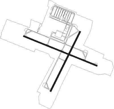
Copenhagen - Copenhagen Roskilde Int
Airport details
| Country | Denmark |
| State | Region Zealand |
| Region | EK |
| Airspace | Copenhagen Ctr |
| Municipality | Roskilde |
| Elevation | 145ft (44m) |
| Timezone | GMT +1 |
| Coordinates | 55.59099, 12.12097 |
| Magnetic var | |
| Type | land |
| Available since | X-Plane v10.40 |
| ICAO code | EKRK |
| IATA code | RKE |
| FAA code | n/a |
Communication
| Copenhagen Roskilde INT ATIS | 123.800 |
| Copenhagen Roskilde INT Handling Ground | 133.150 |
| Copenhagen Roskilde INT Tower | 118.900 |
| Copenhagen Roskilde INT Tower | 119.650 |
| Copenhagen Roskilde INT Approach | 125.525 |
Approach frequencies
| ILS-cat-I | RW11 | 111.5 | 18.00mi |
| ILS-cat-I | RW21 | 108.7 | 18.00mi |
| 3° GS | RW11 | 111.5 | 18.00mi |
| 3° GS | RW21 | 108.7 | 18.00mi |
Nearby Points of Interest:
Snoldelev Stone
-Sankt Laurentii Church Tower
-Kokholm Dyssen
-Gammel Køgegård
-Kirkestræde 20
-Richters Gaard
-Garvergården
-Køge Town Hall
-Edelgave
-Eriksholm Castle
-Rødovre Town Hall
-K.B. Hallen
-Vestvolden
-Carlsberg Laboratory
-Elephant Gate and Tower, Carlsberg
-P. Andersens Vandtårn
-Hassagers Kollegium
-4. Maj Kollegiet
-Lorry
-Tvedes Bryggeri
-Christen Vestbergs og Jørgen Tvedes Stiftelse
-Vega
-Suhrs Friboliger
-Rolighed
-Linoleumshuset

Nearby beacons
| code | identifier | dist | bearing | frequency |
|---|---|---|---|---|
| RK | ROSKILDE (COPENHAGEN) NDB | 4.6 | 285° | 368 |
| BEL | DME | 12 | 353° | 114.65 |
| KAS | KASTRUP (COPENHAGEN) VOR/DME | 16.7 | 90° | 112.50 |
| KOR | KORSA VOR/DME | 18.9 | 253° | 112.80 |
| TNO | TRANO VOR/DME | 25.5 | 285° | 117.40 |
| CDA | CODAN VOR/DME | 36.4 | 156° | 114.90 |
| SVD | DME | 37.9 | 38° | 116.20 |
| AH | ANGELHOLM NDB | 48.2 | 49° | 417 |
| LB | ANGELHOLM NDB | 50.2 | 41° | 370 |
Instrument approach procedures
| runway | airway (heading) | route (dist, bearing) |
|---|---|---|
| RW03 | EGABA (10°) | EGABA 2000ft RK374 (5mi, 305°) 2000ft |
| RW03 | GATMA (66°) | GATMA 3000ft RK376 (2mi, 96°) 3000ft RK374 (3mi, 96°) 2000ft |
| RW03 | SISVA (44°) | SISVA 3000ft RK375 (2mi, 46°) 3000ft RK374 (3mi, 46°) 2000ft |
| RNAV | RK374 2000ft RK373 (4mi, 46°) 2000ft EKRK (6mi, 41°) 177ft (3391mi, 192°) 550ft RK363 (3392mi, 12°) 2000ft RK363 (turn) | |
| RW11 | R3631 (12°) | RK363 2000ft RK367 (5mi, 269°) RK368 (3mi, 80°) 2000ft |
| RW11 | R3632 (12°) | RK363 2000ft RK371 (4mi, 274°) RK368 (3mi, 87°) 2000ft |
| RW11 | R3633 (12°) | RK363 2000ft RK363 (turn) 1700ft |
| RW11 | R3634 (12°) | RK363 2000ft RK363 (turn) 1700ft |
| RW11 | RK361 (105°) | RK361 RK365 (13mi, 105°) 3000ft RK366 (3mi, 106°) 2000ft RK368 (4mi, 105°) 2000ft |
| RW11 | RK362 (73°) | RK362 3000ft RK364 (12mi, 46°) 3000ft RK366 (3mi, 46°) 2000ft RK368 (4mi, 105°) 2000ft |
| RNAV | RK368 2000ft RK363 (2mi, 106°) 1700ft RK369 (4mi, 106°) 475ft (3391mi, 192°) 550ft RK363 (3392mi, 12°) 2000ft RK363 (turn) | |
| RW29 | NUSMO (270°) | NUSMO 2000ft RK292 (5mi, 221°) 2000ft |
| RW29 | SOTAS (309°) | SOTAS 2000ft RK292 (5mi, 41°) 2000ft |
| RW29 | VIBUM (286°) | VIBUM 2000ft RK292 (5mi, 286°) 2000ft |
| RNAV | RK292 2000ft RK291 (4mi, 286°) 2000ft 13THR (4mi, 286°) 690ft EKRK (2mi, 288°) 188ft RK363 (5mi, 284°) 2000ft RK363 (turn) |
Disclaimer
The information on this website is not for real aviation. Use this data with the X-Plane flight simulator only! Data taken with kind consent from X-Plane 12 source code and data files. Content is subject to change without notice.