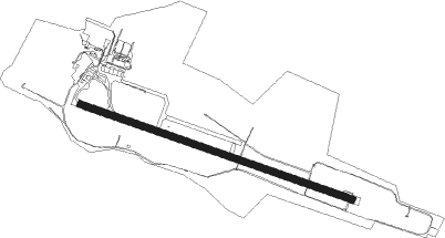
Rønne - Bornholm Ronne
Airport details
| Country | Denmark |
| State | Capital Region of Denmark |
| Region | EK |
| Airspace | Sweden Ctr |
| Municipality | Bornholms Regionskommune |
| Elevation | 47ft (14m) |
| Timezone | GMT +1 |
| Coordinates | 55.06327, 14.75956 |
| Magnetic var | |
| Type | land |
| Available since | X-Plane v10.32 |
| ICAO code | EKRN |
| IATA code | RNN |
| FAA code | n/a |
Communication
| Bornholm Ronne RONNE Tower | 118.325 |
Approach frequencies
| ILS-cat-I | RW11 | 109.35 | 18.00mi |
| ILS-cat-I | RW29 | 110.3 | 18.00mi |
| 3° GS | RW11 | 109.35 | 18.00mi |
| 3° GS | RW29 | 110.3 | 18.00mi |
Nearby beacons
| code | identifier | dist | bearing | frequency |
|---|---|---|---|---|
| ROE | RONNE VORTAC | 0.1 | 339° | 112 |
| FAU | FAUNA (BORNHOLM) NDB | 5.2 | 104° | 334 |
| KD | KRISTIANSTAD NDB | 53.7 | 320° | 375 |
| OEM | KRISTIANSTAD NDB | 59.9 | 325° | 363 |
Instrument approach procedures
| runway | airway (heading) | route (dist, bearing) |
|---|---|---|
| RW11 | LUKAG (91°) | LUKAG 2000ft ODMEI (5mi, 57°) 2000ft |
| RW11 | OGTET (119°) | OGTET 2000ft ODMEI (5mi, 184°) 2000ft |
| RW11 | UMVAP (104°) | UMVAP 2000ft ODMEI (5mi, 105°) 2000ft |
| RNAV | ODMEI 2000ft LEBLO (4mi, 103°) 2000ft PIDES (6mi, 104°) 101ft FAU (6mi, 104°) 2000ft FAU (turn) 2000ft | |
| RW29 | ASBAX (272°) | ASBAX 2000ft ULRED (5mi, 239°) 2000ft |
| RW29 | GOTOG (299°) | GOTOG 2000ft ULRED (5mi, 7°) 2000ft |
| RW29 | INVIR (284°) | INVIR 2000ft ULRED (4mi, 285°) 2000ft |
| RNAV | ULRED 2000ft SOTEP (4mi, 284°) 2000ft TUSBU (6mi, 284°) 103ft (3386mi, 195°) 500ft (turn) 2000ft FAU (3385mi, 15°) 2000ft FAU (turn) 2000ft |
Disclaimer
The information on this website is not for real aviation. Use this data with the X-Plane flight simulator only! Data taken with kind consent from X-Plane 12 source code and data files. Content is subject to change without notice.
