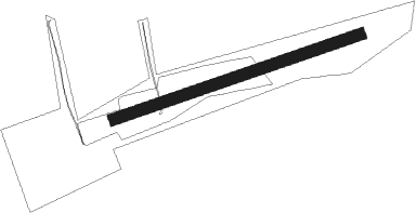
Winseler - Noertrange
Airport details
| Country | Luxembourg |
| State | Diekirch |
| Region | EL |
| Airspace | Brussels Ctr |
| Municipality | Winseler |
| Elevation | 1520ft (463m) |
| Timezone | GMT +1 |
| Coordinates | 49.98111, 5.91778 |
| Magnetic var | |
| Type | land |
| Available since | X-Plane v10.40 |
| ICAO code | ELNT |
| IATA code | n/a |
| FAA code | n/a |
Communication
| Noertrange Noertrange Information | 126.950 |
Nearby Points of Interest:
Mairie de Wiltz
-Bernistap Tunnel
-Château Beurthé
-St. Servatius und St. Matthias (Dahnen)
-St. Peter
-Kirche St. Peter
-St. Johannes der Täufer
-Schloss Bouvier
-Schlossgut Petry
-St. Dionysius (Niedersgegen)
-St. Stephanus
-Sint-Remacluskerk
-Kirche St. Antonius
-Mutter-Gottes-Kirche
-Kapelle St. Bartholomäus
-Villa rustica of Bollendorf
-Büchelturm
-Schloss Holsthum
-Alt St. Remigius
-Schloss Wallerode
-Backhaus Recht
-Schafsbrücke
-Kirche St. Laurentius
-Kirche St. Aldegundis
-Marienkapelle
Runway info
| Runway 08 / 26 | ||
| length | 658m (2159ft) | |
| bearing | 81° / 261° | |
| width | 30m (98ft) | |
| surface | grass | |
Nearby beacons
| code | identifier | dist | bearing | frequency |
|---|---|---|---|---|
| DIK | DIEKIRCH NDB | 10.9 | 119° | 307 |
| LE | LUXEMBOURG NDB | 24.1 | 136° | 318 |
| LUX | LUXEMBOURG VOR/DME | 24.1 | 136° | 112.25 |
| LW | LUXEMBOURG NDB | 24.2 | 145° | 404 |
| ELU | LUXEMBOURG NDB | 24.7 | 125° | 368 |
| WLU | LUXEMBOURG NDB | 25.3 | 162° | 346 |
| SLV | SPA NDB | 29.8 | 359° | 386 |
| SPA | SPANGDAHLEM TACAN | 30.1 | 90° | 109.50 |
| SPI | SPRIMONT VOR/DME | 33.9 | 331° | 113.10 |
| LNO | OLNO VOR/DME | 37.1 | 341° | 112.80 |
| MTZ | METZ NDB | 43.8 | 158° | 354 |
| LGE | LIEGE VOR/DME | 43.9 | 326° | 115.45 |
| ONL | LIEGE NDB | 45.4 | 333° | 290 |
| ETN | ETAIN NDB | 46.1 | 198° | 410 |
| MMD | MONTMEDY VOR | 46.9 | 233° | 109.40 |
| NVO | NOERVENICH VORTAC | 57.5 | 40° | 116.20 |
| WNN | DME | 58.8 | 41° | 109.85 |
| GIX | GEILENKIRCHEN TACAN | 59.1 | 7° | 108.10 |
| MAS | MAASTRICHT VOR/DME | 59.5 | 2° | 108.60 |
| LOU | LORRAINE NDB | 60.6 | 160° | 388 |
| FLO | FLORA VOR/DME | 61.5 | 319° | 112.05 |
| GTQ | GROSTENQUIN VOR/DME | 67.3 | 141° | 111.25 |
Disclaimer
The information on this website is not for real aviation. Use this data with the X-Plane flight simulator only! Data taken with kind consent from X-Plane 12 source code and data files. Content is subject to change without notice.
