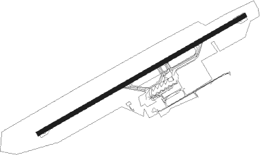
Ålesund - Ålesund Vigra
Airport details
| Country | Norway |
| State | Møre og Romsdal |
| Region | EN |
| Airspace | Polaris Ctr |
| Municipality | Giske |
| Elevation | 66ft (20m) |
| Timezone | GMT +1 |
| Coordinates | 62.56250, 6.11972 |
| Magnetic var | |
| Type | land |
| Available since | X-Plane v10.30 |
| ICAO code | ENAL |
| IATA code | AES |
| FAA code | n/a |
Communication
| Ålesund Vigra ATIS | 128.650 |
| Ålesund Vigra Tower | 118.100 |
| Ålesund Vigra Approach | 129.325 |
Approach frequencies
| ILS-cat-I | RW24 | 111.95 | 18.00mi |
| 3° GS | RW24 | 111.95 | 18.00mi |
Nearby beacons
| code | identifier | dist | bearing | frequency |
|---|---|---|---|---|
| VIG | VIGRA VOR/DME | 2.4 | 263° | 115.80 |
| BVK | BAATVIK NDB | 21.1 | 224° | 362 |
| TAT | TAUTRA (MOLDE) NDB | 22.9 | 82° | 393 |
| HN | HOVDEN NDB | 24.1 | 194° | 389 |
| STG | STEGEN NDB | 42.7 | 161° | 369 |
| AD | ANDA NDB | 44 | 180° | 288 |
Departure and arrival routes
| Transition altitude | 7000ft |
| SID end points | distance | outbound heading | |
|---|---|---|---|
| RW06 | |||
| NELS2E | 102mi | 81° | |
| GIGI2E | 41mi | 106° | |
| TUTO2E | 39mi | 230° | |
| RW24 | |||
| NELS1F | 102mi | 81° | |
| GIGI1F | 41mi | 106° | |
| TUTO1F | 39mi | 230° | |
| STAR starting points | distance | inbound heading | |
|---|---|---|---|
| RW06 | |||
| TUMI4Q | 50.5 | 13° | |
| DEKE2Q | 92.2 | 256° | |
| OBIT1Q | 47.5 | 295° | |
| RW24 | |||
| TUMI3R | 50.5 | 13° | |
| DEKE1R | 92.2 | 256° | |
| OBIT2R | 47.5 | 295° | |
Instrument approach procedures
| runway | airway (heading) | route (dist, bearing) |
|---|---|---|
| RW06-Y | ASKEX (88°) | ASKEX 3000ft UVEVA (5mi, 134°) 3000ft |
| RW06-Y | LAPEV (58°) | LAPEV 5000ft UVEVA (7mi, 314°) 3000ft |
| RNAV | UVEVA 3000ft ATBOL (4mi, 77°) 3000ft ENAL (9mi, 78°) 85ft AL822 (1mi, 78°) AL821 (4mi, 71°) TOMNO (13mi, 280°) TOMNO (turn) 5000ft | |
| RW06-Z | ASKEX (88°) | ASKEX 3000ft UVEVA (5mi, 134°) 3000ft |
| RW06-Z | LAPEV (58°) | LAPEV 5000ft UVEVA (7mi, 314°) 3000ft |
| RNAV | UVEVA 3000ft ATBOL (4mi, 77°) 3000ft AL799 (7mi, 78°) 591ft AL821 (8mi, 74°) TOMNO (13mi, 280°) TOMNO (turn) 5000ft | |
| RW24-Y | BEDUT (248°) | BEDUT 4600ft OMOBA (8mi, 243°) 3000ft |
| RW24-Y | VAVOP (269°) | VAVOP 5800ft BEDUT (12mi, 315°) 4600ft OMOBA (8mi, 243°) 3000ft |
| RNAV | OMOBA 3000ft AL440 (9mi, 251°) 95ft ATBOL (9mi, 258°) TOMNO (12mi, 5°) TOMNO (turn) 5000ft | |
| RW24-Z | BEDUT (248°) | BEDUT 4600ft INROT (5mi, 135°) 4600ft |
| RW24-Z | VAVOP (269°) | VAVOP 5800ft INROT (7mi, 315°) 4600ft |
| RNAV | INROT 4600ft XUDRU (7mi, 258°) 3000ft ENAL (9mi, 258°) 99ft ATBOL (9mi, 258°) TOMNO (12mi, 5°) TOMNO (turn) 5000ft |
Holding patterns
| STAR name | hold at | type | turn | heading* | altitude | leg | speed limit |
|---|---|---|---|---|---|---|---|
| DEKE1R | BEDUT | VHF | right | 334 (154)° | > 4600ft | 1.0min timed | ICAO rules |
| DEKE1R | DEKEB | VHF | left | 70 (250)° | > 7000ft | 1.0min timed | ICAO rules |
| DEKE2Q | DEKEB | VHF | left | 70 (250)° | > 7000ft | 1.0min timed | ICAO rules |
| OBIT1Q | OBITI | VHF | left | 130 (310)° | > 14000ft | 1.0min timed | ICAO rules |
| OBIT2R | OBITI | VHF | left | 130 (310)° | > 14000ft | 1.0min timed | ICAO rules |
| OBIT2R | VAVOP | VHF | left | 153 (333)° | > 5800ft | 1.0min timed | ICAO rules |
| TUMI3R | TUMIM | VHF | right | 191 (11)° | > 14000ft | 1.0min timed | ICAO rules |
| TUMI3R | VAVOP | VHF | left | 153 (333)° | > 5800ft | 1.0min timed | ICAO rules |
| TUMI4Q | TUMIM | VHF | right | 191 (11)° | > 14000ft | 1.0min timed | ICAO rules |
| *) magnetic outbound (inbound) holding course | |||||||
Disclaimer
The information on this website is not for real aviation. Use this data with the X-Plane flight simulator only! Data taken with kind consent from X-Plane 12 source code and data files. Content is subject to change without notice.
