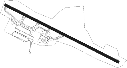
Alta
Airport details
| Country | Norway |
| State | Finnmark |
| Region | EN |
| Airspace | Polaris Ctr |
| Municipality | Alta |
| Elevation | 6ft (2m) |
| Timezone | GMT +1 |
| Coordinates | 69.97611, 23.37167 |
| Magnetic var | |
| Type | land |
| Available since | X-Plane v10.32 |
| ICAO code | ENAT |
| IATA code | ALF |
| FAA code | n/a |
Communication
| Alta Alta Information | 118.175 |
| Alta Alta Tower | 120.400 |
| Alta Alta Tower | 118.100 |
| Alta Alta Approach | 120.400 |
Approach frequencies
| ILS-cat-I | RW11 | 108.9 | 18.00mi |
| 3.7° GS | RW11 | 108.9 | 18.00mi |
Nearby Points of Interest:
Jiepmaluokta
-Kåfjord, Alta
Nearby beacons
| code | identifier | dist | bearing | frequency |
|---|---|---|---|---|
| ATA | ALTA VOR/DME | 0 | 3° | 117.40 |
| ALA | ALTA NDB | 1.8 | 282° | 358 |
| TV | TALVIK (ALTA) NDB | 9.1 | 283° | 330 |
| HMF | HAMMERFEST VOR/DME | 44.2 | 24° | 112.40 |
| FOR | FORSOL (HAMMERFEST) NDB | 45.6 | 32° | 318 |
Departure and arrival routes
| Transition altitude | 7000ft |
| SID end points | distance | outbound heading | |
|---|---|---|---|
| RW11 | |||
| KOMI1A | 21mi | 31° | |
| PEME1A | 13mi | 86° | |
| LUVE1A, LUVE1W | 30mi | 244° | |
| NATE1W, NATE1A | 27mi | 266° | |
| ELSE1A | 16mi | 294° | |
| RW29 | |||
| KOMI1B | 21mi | 31° | |
| PEME1B | 13mi | 86° | |
| LUVE1B | 30mi | 244° | |
| NATE1B | 27mi | 266° | |
| ELSE1B | 16mi | 294° | |
| STAR starting points | distance | inbound heading | |
|---|---|---|---|
| RW11 | |||
| BADI1Q | 26.2 | 80° | |
| UDSA1Q | 29.8 | 92° | |
| ORVA1Q | 21.7 | 132° | |
Instrument approach procedures
| runway | airway (heading) | route (dist, bearing) |
|---|---|---|
| RW11 | EKTOX (96°) | EKTOX 5000ft OGDOL (5mi, 74°) 5000ft |
| RW11 | RIXIB (109°) | RIXIB 5000ft OGDOL (5mi, 209°) 5000ft |
| RNAV | OGDOL 5000ft AT420 (5mi, 101°) 4000ft ENAT (11mi, 102°) 60ft ATMOM (10mi, 128°) ATMOM (turn) 5000ft |
Holding patterns
| STAR name | hold at | type | turn | heading* | altitude | leg | speed limit |
|---|---|---|---|---|---|---|---|
| BADI1Q | EKTOX | VHF | right | 218 (38)° | > 5000ft | 1.0min timed | ICAO rules |
| UDSA1Q | EKTOX | VHF | right | 218 (38)° | > 5000ft | 1.0min timed | ICAO rules |
| *) magnetic outbound (inbound) holding course | |||||||
Disclaimer
The information on this website is not for real aviation. Use this data with the X-Plane flight simulator only! Data taken with kind consent from X-Plane 12 source code and data files. Content is subject to change without notice.