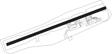
Førde - Bringeland
Airport details
| Country | Norway |
| State | Sogn og Fjordane |
| Region | EN |
| Airspace | Polaris Ctr |
| Municipality | Sunnfjord |
| Elevation | 1043ft (318m) |
| Timezone | GMT +1 |
| Coordinates | 61.39111, 5.75694 |
| Magnetic var | |
| Type | land |
| Available since | X-Plane v10.40 |
| ICAO code | ENBL |
| IATA code | FDE |
| FAA code | n/a |
Communication
| Bringeland AFIS | 118.450 |
Approach frequencies
| LOC | RW07 | 110.7 | 18.00mi |
| LOC | RW25 | 109.35 | 18.00mi |
Nearby Points of Interest:
Osen gard
-North Østerdalen Museums
-Lavik prestegård
Nearby beacons
| code | identifier | dist | bearing | frequency |
|---|---|---|---|---|
| BL | BRINGELAND NDB | 0.1 | 108° | 374 |
| FLO | FLORO VOR/DME | 24 | 284° | 112.30 |
| AD | ANDA NDB | 28.2 | 39° | 288 |
| VNG | VANGSNES NDB | 28.7 | 104° | 404 |
| STG | STEGEN NDB | 33.1 | 52° | 369 |
| HN | HOVDEN NDB | 46.9 | 19° | 389 |
| BVK | BAATVIK NDB | 51 | 4° | 362 |
| VOO | VOLLO VOR/DME | 53.7 | 217° | 114.85 |
Departure and arrival routes
| Transition altitude | 6000ft |
| SID end points | distance | outbound heading | |
|---|---|---|---|
| RW25 | |||
| DOPU1D | 58mi | 105° | |
| NIDG1D | 34mi | 251° | |
| STAR starting points | distance | inbound heading | |
|---|---|---|---|
| RW07 | |||
| OLDA1N | 25.6 | 61° | |
| EMLE1N | 57.7 | 276° | |
| RW25 | |||
| OLDA1P | 25.6 | 61° | |
| EMLE1P | 57.7 | 276° | |
Instrument approach procedures
| runway | airway (heading) | route (dist, bearing) |
|---|---|---|
| RW07 | IDONI (71°) | IDONI 5500ft ESEKI (5mi, 328°) 5500ft |
| RW07 | SUVEN (91°) | SUVEN 5500ft ESEKI (5mi, 148°) 5500ft |
| RNAV | ESEKI 5500ft MOMAN (4mi, 82°) 5200ft ENBL (10mi, 82°) 1079ft BL503 (6mi, 82°) IDONI (21mi, 254°) 5500ft IDONI (turn) 5500ft | |
| RW25-Y | INDUX (262°) | INDUX 7100ft INGOS (5mi, 262°) 6500ft |
| RW25-Y | LELPO (272°) | LELPO 6500ft INGOS (5mi, 330°) 6500ft |
| RW25-Y | REPRI (251°) | REPRI 6600ft INGOS (5mi, 149°) 6500ft |
| RNAV | INGOS 6500ft BL404 (7mi, 262°) 4500ft ENBL (7mi, 262°) 1095ft MOMAN (10mi, 262°) MOMAN (turn) 4000ft MOMAN (turn) MOMAN (turn) 6000ft | |
| RW25-Z | INDUX (262°) | INDUX 7100ft INGOS (5mi, 262°) 6500ft |
| RW25-Z | LELPO (272°) | LELPO 6500ft INGOS (5mi, 330°) 6500ft |
| RW25-Z | REPRI (251°) | REPRI 6600ft INGOS (5mi, 149°) 6500ft |
| RNAV | INGOS 6500ft XIBUR (4mi, 262°) 6000ft BL400 (8mi, 262°) 2220ft (3697mi, 185°) 2500ft BL403 (3693mi, 5°) IDONI (9mi, 248°) IDONI (turn) 5500ft |
Disclaimer
The information on this website is not for real aviation. Use this data with the X-Plane flight simulator only! Data taken with kind consent from X-Plane 12 source code and data files. Content is subject to change without notice.