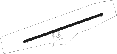
Berlevåg - Berlevaag
Airport details
| Country | Norway |
| State | Finnmark |
| Region | EN |
| Airspace | Polaris Ctr |
| Municipality | Berlevåg |
| Elevation | 41ft (12m) |
| Timezone | GMT +1 |
| Coordinates | 70.87139, 29.03417 |
| Magnetic var | |
| Type | land |
| Available since | X-Plane v10.40 |
| ICAO code | ENBV |
| IATA code | BVG |
| FAA code | n/a |
Communication
Approach frequencies
| LOC | RW24 | 110.9 | 18.00mi |
Nearby beacons
| code | identifier | dist | bearing | frequency |
|---|---|---|---|---|
| BV | BERLEVAG NDB | 0.4 | 85° | 399 |
| BX | BATSFJORD NDB | 20.7 | 111° | 348 |
| SDA | SEIDA VOR/DME | 42.8 | 237° | 113.60 |
| VD | VADSO NDB | 51.3 | 134° | 342 |
Instrument approach procedures
| runway | airway (heading) | route (dist, bearing) |
|---|---|---|
| RW06 | ENUMA (85°) | ENUMA 7000ft BV503 (5mi, 85°) 5000ft |
| RW06 | KUKIX (77°) | KUKIX 7000ft BV503 (5mi, 319°) 5000ft |
| RW06 | OLPID (91°) | OLPID 5000ft BV503 (5mi, 139°) 5000ft |
| RNAV | BV503 5000ft BV502 (5mi, 85°) 4000ft ENBV (10mi, 85°) 93ft ASMEL (9mi, 85°) ASMEL (turn) 4000ft | |
| RW24 | APRUV (253°) | APRUV 4000ft ASMEL (5mi, 141°) 2000ft |
| RW24 | GIVOP (274°) | GIVOP 4000ft ASMEL (5mi, 321°) 2000ft |
| RNAV | ASMEL 2000ft BV404 (5mi, 265°) 2000ft ENBV (5mi, 265°) 79ft BV405 (6mi, 265°) GIVOP (16mi, 91°) GIVOP (turn) 4000ft |
Disclaimer
The information on this website is not for real aviation. Use this data with the X-Plane flight simulator only! Data taken with kind consent from X-Plane 12 source code and data files. Content is subject to change without notice.
