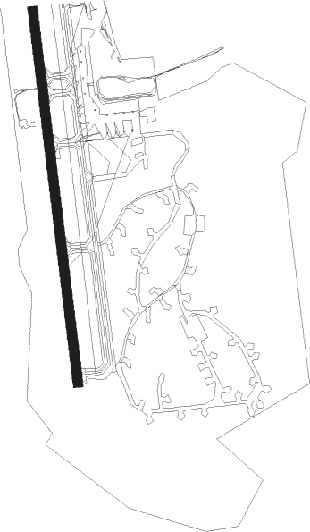
Evenes - Harstad Narvik Evenes
Airport details
| Country | Norway |
| State | Nordland |
| Region | EN |
| Airspace | Polaris Ctr |
| Municipality | Evenes |
| Elevation | 83ft (25m) |
| Timezone | GMT +1 |
| Coordinates | 68.48889, 16.67833 |
| Magnetic var | |
| Type | land |
| Available since | X-Plane v10.40 |
| ICAO code | ENEV |
| IATA code | EVE |
| FAA code | n/a |
Communication
| Harstad Narvik Evenes ATIS | 126.025 |
| Harstad Narvik Evenes Tower | 118.000 |
| Harstad Narvik Evenes Tower | 120.100 |
| Harstad Narvik Evenes Approach | 120.100 |
Approach frequencies
| ILS-cat-I | RW17 | 108.9 | 18.00mi |
| 3.8° GS | RW17 | 108.9 | 18.00mi |
Nearby Points of Interest:
Sandtorgholmen
Nearby beacons
| code | identifier | dist | bearing | frequency |
|---|---|---|---|---|
| EVS | EVENES TACAN | 0.1 | 306° | 134 |
| EVD | EVENES VOR/DME | 1.8 | 174° | 117.35 |
| FS | FJELLSTAD NDB | 6.5 | 357° | 396 |
| ODD | ODDEN NDB | 13.4 | 261° | 365 |
| OYA | ANDOYA TACAN | 49.2 | 326° | 109.10 |
| AND | ANDOYA VOR/DME | 49.3 | 326° | 112.20 |
Departure and arrival routes
| Transition altitude | 7000ft |
| SID end points | distance | outbound heading | |
|---|---|---|---|
| RW17 | |||
| BARV1E | 33mi | 39° | |
| LAVN1E, LAVN2D | 30mi | 73° | |
| AMIM1E | 37mi | 201° | |
| GEPT1E | 51mi | 242° | |
| PIKO1E, PIKO2W | 29mi | 262° | |
| EVAN2E | 29mi | 326° | |
| RW35 | |||
| BARV4F | 33mi | 39° | |
| LAVN4F | 30mi | 73° | |
| AMIM1F | 37mi | 201° | |
| GEPT1F | 51mi | 242° | |
| PIKO1F, PIKO1X | 29mi | 262° | |
| EVAN4F | 29mi | 326° | |
| STAR starting points | distance | inbound heading | |
|---|---|---|---|
| RW17 | |||
| PENO1L | 35.5 | 46° | |
| PIKO1L | 28.7 | 82° | |
| EVAN2L | 29.0 | 146° | |
| ELDU2L | 30.7 | 229° | |
| OSKU1L | 21.5 | 272° | |
| GILE2L | 29.2 | 318° | |
| RW35 | |||
| PENO1M | 35.5 | 46° | |
| PIKO1M | 28.7 | 82° | |
| EVAN3M | 29.0 | 146° | |
| ELDU1M | 30.7 | 229° | |
| OSKU1M | 21.5 | 272° | |
| GILE1M | 29.2 | 318° | |
Instrument approach procedures
| runway | airway (heading) | route (dist, bearing) |
|---|---|---|
| RW17 | EVPUS (228°) | EVPUS 6000ft EV512 (7mi, 269°) 4500ft |
| RW17 | LALOL (173°) | LALOL 6000ft EV512 (5mi, 173°) 4500ft |
| RW17 | RIMER (126°) | RIMER 6000ft EV512 (7mi, 89°) 4500ft |
| RNAV | EV512 4500ft EV513 (5mi, 173°) 4000ft ENEV (11mi, 173°) 132ft EV514 (3mi, 173°) ODD (13mi, 266°) ODD (turn) 3800ft ODD (turn) ODD (turn) 5000ft | |
| RW35-X | LEGLU (67°) | LEGLU 7000ft STETI (8mi, 97°) 7000ft |
| RW35-X | MAXED (0°) | MAXED 7000ft STETI (7mi, 280°) 7000ft |
| RNAV | STETI 7000ft EV722 (9mi, 50°) 4000ft EV721 (7mi, 51°) EV720 (1mi, 28°) ENEV (3mi, 353°) 131ft OKNOT (7mi, 353°) OKNOT (turn) 3800ft OKNOT (turn) OKNOT (turn) 5000ft | |
| RW35-Z | LEGLU (67°) | LEGLU 7000ft STETI (8mi, 97°) 7000ft |
| RW35-Z | MAXED (0°) | MAXED 7000ft STETI (7mi, 280°) 7000ft |
| RNAV | STETI 7000ft EV712 (11mi, 55°) 3800ft EV710 (8mi, 31°) 451ft FS (8mi, 356°) FS (turn) 3800ft FS (turn) FS (turn) 5000ft |
Holding patterns
| STAR name | hold at | type | turn | heading* | altitude | leg | speed limit |
|---|---|---|---|---|---|---|---|
| ELDU1M | MAXED | VHF | left | 13 (193)° | > 7000ft | 1.0min timed | ICAO rules |
| ELDU2L | LALOL | VHF | left | 350 (170)° | > 6000ft | 1.0min timed | ICAO rules |
| EVAN2L | LALOL | VHF | left | 350 (170)° | > 6000ft | 1.0min timed | ICAO rules |
| EVAN3M | LEGLU | VHF | right | 1 (181)° | > 7000ft | 1.0min timed | ICAO rules |
| GILE1M | MAXED | VHF | left | 13 (193)° | > 7000ft | 1.0min timed | ICAO rules |
| GILE2L | EVPUS | VHF | right | 132 (312)° | > 6000ft | 1.0min timed | ICAO rules |
| OSKU1L | EVPUS | VHF | right | 132 (312)° | > 6000ft | 1.0min timed | ICAO rules |
| OSKU1M | MAXED | VHF | left | 13 (193)° | > 7000ft | 1.0min timed | ICAO rules |
| PENO1L | RIMER | VHF | left | 189 (9)° | > 6000ft | 1.0min timed | ICAO rules |
| PENO1M | STETI | VHF | left | 194 (14)° | > 7000ft | 1.0min timed | ICAO rules |
| PIKO1L | RIMER | VHF | left | 189 (9)° | > 6000ft | 1.0min timed | ICAO rules |
| PIKO1M | LEGLU | VHF | right | 1 (181)° | > 7000ft | 1.0min timed | ICAO rules |
| *) magnetic outbound (inbound) holding course | |||||||
Disclaimer
The information on this website is not for real aviation. Use this data with the X-Plane flight simulator only! Data taken with kind consent from X-Plane 12 source code and data files. Content is subject to change without notice.