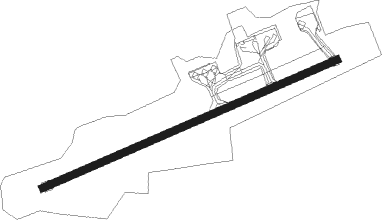
Florø
Airport details
| Country | Norway |
| State | Sogn og Fjordane |
| Region | EN |
| Airspace | Polaris Ctr |
| Municipality | Kinn |
| Elevation | 37ft (11m) |
| Timezone | GMT +1 |
| Coordinates | 61.58361, 5.02472 |
| Magnetic var | |
| Type | land |
| Available since | X-Plane v10.40 |
| ICAO code | ENFL |
| IATA code | FRO |
| FAA code | n/a |
Communication
| Florø ATIS | 124.625 |
| Florø AFIS | 119.200 |
Approach frequencies
| LOC | RW07 | 108.9 | 18.00mi |
Nearby beacons
| code | identifier | dist | bearing | frequency |
|---|---|---|---|---|
| FLO | FLORO VOR/DME | 0.1 | 246° | 112.30 |
| BL | BRINGELAND NDB | 24 | 105° | 374 |
| HN | HOVDEN NDB | 44.8 | 60° | 389 |
| BVK | BAATVIK NDB | 45.2 | 50° | 362 |
Departure and arrival routes
| Transition altitude | 6000ft |
| SID end points | distance | outbound heading | |
|---|---|---|---|
| RW07 | |||
| DOPU1G | 82mi | 105° | |
| NIDG1G, NIDG1W | 32mi | 202° | |
| RW25 | |||
| DOPU1H | 82mi | 105° | |
| NIDG1H | 32mi | 202° | |
| STAR starting points | distance | inbound heading | |
|---|---|---|---|
| RW07 | |||
| EMLE1Q | 80.9 | 278° | |
| OLDA1Q | 31.1 | 344° | |
| RW25 | |||
| EMLE2R | 80.9 | 278° | |
| OLDA2R | 31.1 | 344° | |
Instrument approach procedures
| runway | airway (heading) | route (dist, bearing) |
|---|---|---|
| RW07-Y | GOSLI (94°) | GOSLI 4000ft UPOSA (5mi, 144°) 3200ft |
| RW07-Y | POGUX (63°) | POGUX 4000ft UPOSA (5mi, 324°) 3200ft |
| RNAV | UPOSA 3200ft FL440 (4mi, 81°) 1800ft ENFL (5mi, 81°) 87ft FL441 (turn) FL402 (7mi, 263°) GOSLI (5mi, 289°) GOSLI (turn) 4000ft | |
| RW07-Z | GOSLI (94°) | GOSLI 4000ft UPOSA (5mi, 144°) 3200ft |
| RW07-Z | POGUX (63°) | POGUX 4000ft UPOSA (5mi, 324°) 3200ft |
| RNAV | UPOSA 3200ft LEDMO (4mi, 81°) 1800ft 25THR (2mi, 80°) 1010ft ENFL (3mi, 81°) 87ft FL402 (6mi, 263°) GOSLI (5mi, 289°) GOSLI (turn) 4000ft | |
| RW25 | IDBIB (281°) | IDBIB 5400ft VAXEM (3mi, 17°) 5000ft |
| RW25 | PETED (266°) | PETED 5700ft VAXEM (3mi, 197°) 5000ft |
| RNAV | VAXEM 5000ft LEKBU (3mi, 274°) 4000ft FL710 (9mi, 274°) 379ft GOSLI (11mi, 273°) GOSLI (turn) 4000ft | |
| RWNVD | APSUS (294°) | APSUS 5400ft UNBOG (5mi, 293°) 5400ft |
| RWNVD | ESATO (280°) | ESATO 5600ft UNBOG (5mi, 242°) 5400ft |
| RWNVD | RIKDU (316°) | RIKDU 5400ft UNBOG (5mi, 62°) 5400ft |
| RNAV | UNBOG 5400ft FL501 (5mi, 293°) 3200ft FL500 (6mi, 293°) 640ft GOSLI (11mi, 276°) GOSLI (turn) 4000ft |
Disclaimer
The information on this website is not for real aviation. Use this data with the X-Plane flight simulator only! Data taken with kind consent from X-Plane 12 source code and data files. Content is subject to change without notice.
