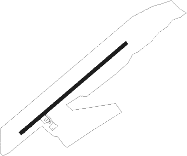
Arendal - Gullknapp
Airport details
| Country | Norway |
| State | Aust-Agder |
| Region | EN |
| Airspace | Polaris Ctr |
| Municipality | Froland |
| Elevation | 415ft (126m) |
| Timezone | GMT +1 |
| Coordinates | 58.51833, 8.70778 |
| Magnetic var | |
| Type | land |
| Available since | X-Plane v10.40 |
| ICAO code | ENGK |
| IATA code | n/a |
| FAA code | n/a |
Communication
| Gullknapp Gullknapp Information | 129.900 |
Nearby beacons
| code | identifier | dist | bearing | frequency |
|---|---|---|---|---|
| SVA | SVENSHEIA VOR/DME | 36.2 | 242° | 112.10 |
Departure and arrival routes
| Transition altitude | 7000ft |
| SID end points | distance | outbound heading | |
|---|---|---|---|
| RW05 | |||
| LANT1E | 78mi | 235° | |
| BEDI1E | 46mi | 275° | |
| RW23 | |||
| LANT1F | 78mi | 235° | |
| BEDI1F | 46mi | 275° | |
| STAR starting points | distance | inbound heading | |
|---|---|---|---|
| RW05 | |||
| RASV1U | 76.7 | 28° | |
| BEDI1U | 46.2 | 95° | |
| LUTO1U | 26.3 | 255° | |
| RW23 | |||
| RASV1W | 76.7 | 28° | |
| BEDI1W | 46.2 | 95° | |
| LUTO1W | 26.3 | 255° | |
Instrument approach procedures
| runway | airway (heading) | route (dist, bearing) |
|---|---|---|
| RW05 | GK501 (69°) | GK501 3200ft GK502 (5mi, 69°) 3000ft |
| RW05 | INSAP (54°) | INSAP 3000ft GK501 (4mi, 311°) 3000ft GK502 (5mi, 69°) 3000ft |
| RW05 | UBEDA (80°) | UBEDA 4000ft GK501 (6mi, 100°) 3000ft GK502 (5mi, 69°) 3000ft |
| RNAV | GK502 3000ft ENGK (8mi, 69°) 441ft GK503 (15mi, 69°) INSAP (29mi, 243°) 3000ft INSAP (turn) 3000ft | |
| RW23 | ROGOT (232°) | ROGOT 5000ft LULES (5mi, 126°) 3500ft |
| RW23 | TOVBI (262°) | TOVBI 5000ft LULES (5mi, 306°) 3500ft |
| RNAV | LULES 3500ft GK616 (5mi, 249°) 3000ft ENGK (8mi, 249°) 465ft GK617 (4mi, 249°) ROGOT (18mi, 56°) ROGOT (turn) 5000ft |
Holding patterns
| STAR name | hold at | type | turn | heading* | altitude | leg | speed limit |
|---|---|---|---|---|---|---|---|
| BEDI1W | ROGOT | VHF | left | 321 (141)° | > 5000ft | 1.0min timed | 200 |
| LUTO1U | INSAP | VHF | right | 146 (326)° | > 3000ft | 1.0min timed | ICAO rules |
| RASV1U | INSAP | VHF | right | 146 (326)° | > 3000ft | 1.0min timed | ICAO rules |
| *) magnetic outbound (inbound) holding course | |||||||
Disclaimer
The information on this website is not for real aviation. Use this data with the X-Plane flight simulator only! Data taken with kind consent from X-Plane 12 source code and data files. Content is subject to change without notice.
