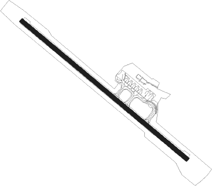
Karmøy - Haugesund Lufthavn Karmoy
Airport details
| Country | Norway |
| State | Rogaland |
| Region | EN |
| Airspace | Polaris Ctr |
| Municipality | Karmøy |
| Elevation | 76ft (23m) |
| Timezone | GMT +1 |
| Coordinates | 59.34333, 5.21250 |
| Magnetic var | |
| Type | land |
| Available since | X-Plane v10.40 |
| ICAO code | ENHD |
| IATA code | HAU |
| FAA code | n/a |
Communication
| Haugesund Lufthavn Karmoy ATIS | 118.175 |
| Haugesund Lufthavn Karmoy Tower | 120.500 |
| Haugesund Lufthavn Karmoy Tower | 121.100 |
Approach frequencies
| ILS-cat-I | RW13 | 109.1 | 18.00mi |
| 3° GS | RW13 | 109.1 | 18.00mi |
Nearby beacons
| code | identifier | dist | bearing | frequency |
|---|---|---|---|---|
| KRM | KARMOY (HAUGESUND) VOR/DME | 0.3 | 287° | 115.15 |
| STD | STORD VOR/DME | 26.9 | 17° | 113.40 |
| SOA | SOLA TACAN | 30.9 | 138° | 112.25 |
| ZOL | SOLA VOR/DME | 31 | 138° | 116.85 |
| FLE | FLESLAND TACAN | 57.4 | 0° | 114.50 |
| FLS | FLESLAND VOR/DME | 58.1 | 360° | 115.55 |
Departure and arrival routes
| Transition altitude | 7000ft |
| SID end points | distance | outbound heading | |
|---|---|---|---|
| RW13 | |||
| ODIN1J | 47mi | 76° | |
| PEVE1J | 71mi | 118° | |
| BIVK1J | 68mi | 134° | |
| RUMO1J | 69mi | 165° | |
| GENV1J | 19mi | 315° | |
| RW31 | |||
| ODIN1K | 47mi | 76° | |
| PEVE1K | 71mi | 118° | |
| BIVK1K | 68mi | 134° | |
| RUMO1K | 69mi | 165° | |
| GENV1K | 19mi | 315° | |
| STAR starting points | distance | inbound heading | |
|---|---|---|---|
| RW13 | |||
| UNBU2U | 72.9 | 2° | |
| BEGO1U | 17.7 | 170° | |
| UPDE1U | 58.1 | 180° | |
| ULVO1U | 45.8 | 262° | |
| RIVE1U | 69.1 | 305° | |
| RW31 | |||
| UNBU2V | 72.9 | 2° | |
| BEGO1V | 17.7 | 170° | |
| UPDE1V | 58.1 | 180° | |
| ULVO1V | 45.8 | 262° | |
| RIVE2V | 69.1 | 305° | |
Instrument approach procedures
| runway | airway (heading) | route (dist, bearing) |
|---|---|---|
| RW13-X | INRIX (256°) | INRIX 4000ft HD417 (15mi, 263°) 4000ft |
| RNAV | HD417 4000ft HD416 (5mi, 263°) 4000ft HD415 (5mi, 262°) HD400 (4mi, 207°) ENHD (2mi, 116°) 112ft RIVNU (6mi, 117°) RIVNU (turn) 2500ft | |
| RW13-Z | ASMID (143°) | ASMID 4000ft BAVSA (5mi, 242°) 2000ft |
| RW13-Z | EDODI (100°) | EDODI 2000ft BAVSA (5mi, 62°) 2000ft |
| RNAV | BAVSA 2000ft ABMAR (4mi, 116°) 2000ft ENHD (7mi, 116°) 112ft RIVNU (6mi, 117°) 2500ft RIVNU (turn) 2500ft | |
| RW31 | BAMAP (282°) | BAMAP 4000ft LESMU (5mi, 243°) 3000ft |
| RW31 | OXERO (320°) | OXERO 3000ft LESMU (5mi, 62°) 3000ft |
| RNAV | LESMU 3000ft ARGID (4mi, 297°) 2500ft ENHD (8mi, 297°) 137ft BAVSA (11mi, 296°) 2500ft KRM (10mi, 117°) 2500ft KRM (turn) 2500ft |
Holding patterns
| STAR name | hold at | type | turn | heading* | altitude | leg | speed limit |
|---|---|---|---|---|---|---|---|
| RIVE1U | RIVEX | VHF | right | 144 (324)° | > 10000ft | 1.0min timed | ICAO rules |
| RIVE2V | RIVEX | VHF | right | 144 (324)° | > 10000ft | 1.0min timed | ICAO rules |
| ULVO1U | ULVOS | VHF | left | 68 (248)° | > 10000ft | 1.0min timed | ICAO rules |
| ULVO1V | ULVOS | VHF | left | 68 (248)° | > 10000ft | 1.0min timed | ICAO rules |
| UNBU2U | UNBUD | VHF | left | 179 (359)° | > 20000ft | 1.0min timed | ICAO rules |
| UNBU2V | UNBUD | VHF | left | 179 (359)° | > 20000ft | 1.0min timed | ICAO rules |
| *) magnetic outbound (inbound) holding course | |||||||
Disclaimer
The information on this website is not for real aviation. Use this data with the X-Plane flight simulator only! Data taken with kind consent from X-Plane 12 source code and data files. Content is subject to change without notice.
