Hasvik
Airport details
| Country | Norway |
| State | Finnmark |
| Region | EN |
| Airspace | Polaris Ctr |
| Municipality | Hasvik |
| Elevation | 20ft (6m) |
| Timezone | GMT +1 |
| Coordinates | 70.48666, 22.13972 |
| Magnetic var | |
| Type | land |
| Available since | X-Plane v10.40 |
| ICAO code | ENHK |
| IATA code | HAA |
| FAA code | n/a |
Communication
| HASVIK INFO | 119.900 |
Approach frequencies
| LOC | RW29 | 111.5 | 18.00mi |
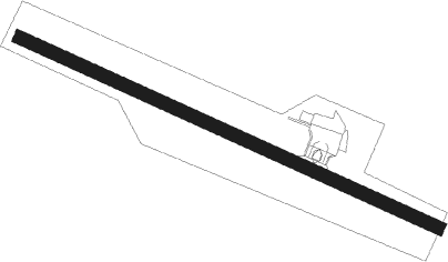
Runway info
| Runway 11 / 29 | ||
| length | 1035m (3396ft) | |
| bearing | 100° / 280° | |
| width | 30m (98ft) | |
| surface | asphalt | |
| displ threshold | 40m (131ft) / 110m (361ft) | |
Nearby beacons
| code | identifier | dist | bearing | frequency |
|---|---|---|---|---|
| HK | HASVIK NDB | 0.2 | 293° | 386 |
| TV | TALVIK (ALTA) NDB | 30.9 | 116° | 330 |
Instrument approach procedures
| runway | airway (heading) | route (dist, bearing) |
|---|---|---|
| RW11 | ETNED (92°) | ETNED 4400ft HK502 (4mi, 59°) 2800ft |
| RW11 | LURIV (113°) | LURIV 4000ft HK502 (4mi, 239°) 2800ft |
| RNAV | HK502 2800ft HK501 (4mi, 100°) 2400ft ENHK (6mi, 100°) 71ft HK500 (3mi, 100°) HK500 (turn) 2000ft HK (4mi, 281°) HK (turn) 5000ft | |
| RW29 | DUPPE (302°) | DUPPE 5000ft HK403 (3mi, 59°) 4200ft HK402 (3mi, 59°) 3400ft |
| RW29 | GOKKI (273°) | GOKKI 4100ft HK402 (3mi, 239°) 3400ft |
| RW29 | VIDDE (280°) | VIDDE 5000ft HK402 (4mi, 279°) 3400ft |
| RNAV | HK402 3400ft HK401 (3mi, 281°) 2500ft ENHK (6mi, 280°) 62ft HK406 (6mi, 280°) HK (6mi, 100°) HK (turn) 5000ft |
Disclaimer
The information on this website is not for real aviation. Use this data with the X-Plane flight simulator only! Data taken with kind consent from X-Plane 12 source code and data files. Content is subject to change without notice.