Kjeller
Airport details
| Country | Norway |
| State | Akershus |
| Region | EN |
| Airspace | Polaris Ctr |
| Municipality | Lillestrøm |
| Elevation | 354ft (108m) |
| Timezone | GMT +1 |
| Coordinates | 59.96894, 11.04708 |
| Magnetic var | |
| Type | land |
| Available since | X-Plane v10.40 |
| ICAO code | ENKJ |
| IATA code | n/a |
| FAA code | n/a |
Communication
| Kjeller ATC | 119.100 |
Nearby Points of Interest:
Skedsmo prestegård
-Rudskulen
-Grorud brannstasjon
-Fetsund Booms
-Rommiskolen
-Losby Gods
-Bredtveit
-Alnabru Station
-Klosterheim
-Grefsenåsen kapell
-Teisen skole
-Øyeren
-Ullensaker prestegård
-Grefsen Sanatorium
-Aker University Hospital
-Christinedal
-Blaker Church
-Sørbråten Chapel
-Kanonhallen
-Grefsen og Disen Velhus
-Blaker Fortress
-Grefsen Senior High School
-Tallberget
-Den norske Eterfabrikk
-Dalen Church
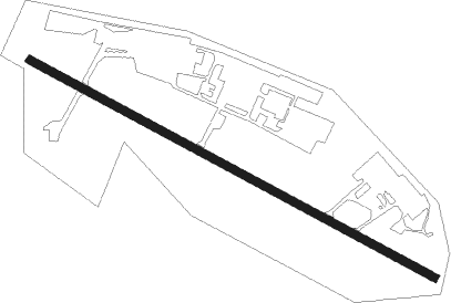
Runway info
| Runway 12 / 30 | ||
| length | 1617m (5305ft) | |
| bearing | 108° / 288° | |
| width | 30m (98ft) | |
| surface | asphalt | |
| displ threshold | 218m (715ft) / 71m (233ft) | |
| blast zone | 78m (256ft) / 0m (0ft) | |
Nearby beacons
| code | identifier | dist | bearing | frequency |
|---|---|---|---|---|
| GRM | GARDERMOEN VOR/DME | 13.4 | 7° | 115.95 |
| ERB | DME | 24 | 58° | 116.25 |
| NLK | DME | 30.4 | 353° | 115.60 |
| RYG | RYGGE TACAN | 36.6 | 201° | 113.50 |
| YG | ENGE NDB | 36.6 | 200° | 396 |
| RG | TUNE (MOSS) NDB | 38.7 | 184° | 381 |
| BLA | DME | 45.9 | 45° | 115.20 |
| HAA | HAMAR NDB | 50.9 | 2° | 371 |
| TOR | TORP VOR/DME | 53.6 | 225° | 113.85 |
Disclaimer
The information on this website is not for real aviation. Use this data with the X-Plane flight simulator only! Data taken with kind consent from X-Plane 12 source code and data files. Content is subject to change without notice.