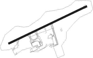
Kirkenes - Kirkenes Høybuktmoen
Airport details
| Country | Norway |
| State | Finnmark |
| Region | EN |
| Airspace | Polaris Ctr |
| Municipality | South Varanki |
| Elevation | 283ft (86m) |
| Timezone | GMT +1 |
| Coordinates | 69.72500, 29.88778 |
| Magnetic var | |
| Type | land |
| Available since | X-Plane v10.40 |
| ICAO code | ENKR |
| IATA code | KKN |
| FAA code | n/a |
Communication
| Kirkenes Høybuktmoen ATIS | 118.025 |
| Kirkenes Høybuktmoen KIRKENES Tower | 120.350 |
Approach frequencies
| ILS-cat-I | RW23 | 110.3 | 18.00mi |
| 3.4° GS | RW23 | 110.3 | 18.00mi |
Nearby Points of Interest:
Holmengrå
Nearby beacons
| code | identifier | dist | bearing | frequency |
|---|---|---|---|---|
| KIK | KIRKENES VOR/DME | 0.3 | 266° | 112 |
| VD | VADSO NDB | 20.4 | 359° | 342 |
| BX | BATSFJORD NDB | 53.1 | 349° | 348 |
Departure and arrival routes
| Transition altitude | 7000ft |
| SID end points | distance | outbound heading | |
|---|---|---|---|
| RW05 | |||
| VANO2E | 18mi | 155° | |
| SIVN2E | 16mi | 257° | |
| VADL2E | 23mi | 271° | |
| ROVA2E | 29mi | 273° | |
| SDA2E | 48mi | 286° | |
| RW23 | |||
| VANO1F | 18mi | 155° | |
| SIVN1F | 16mi | 257° | |
| VADL1F | 23mi | 271° | |
| ROVA1F | 29mi | 273° | |
| SDA1F | 48mi | 286° | |
| STAR starting points | distance | inbound heading | |
|---|---|---|---|
| RW05 | |||
| VADL1R | 22.7 | 91° | |
| ROVA1R | 28.5 | 93° | |
| SDA1R | 48.2 | 106° | |
| VANO1R | 18.4 | 335° | |
| RW23 | |||
| SIVN1Q | 16.3 | 77° | |
| VADL1Q | 22.7 | 91° | |
| ROVA1Q | 28.5 | 93° | |
| SDA1Q | 48.2 | 106° | |
| VANO1Q | 18.4 | 335° | |
Instrument approach procedures
| runway | airway (heading) | route (dist, bearing) |
|---|---|---|
| RW05 | GOBAD (91°) | GOBAD 5500ft LANLA (6mi, 131°) 3000ft |
| RW05 | OSPOG (72°) | OSPOG 3000ft LANLA (5mi, 312°) 3000ft |
| RNAV | LANLA 3000ft KR408 (6mi, 82°) 3000ft ENKR (7mi, 82°) 330ft DOGOD (13mi, 72°) DOGOD (turn) 3000ft | |
| RW23 | DOGOD (252°) | DOGOD 3000ft UNDEN (5mi, 133°) 3000ft |
| RNAV | UNDEN 3000ft KR505 (4mi, 263°) 2900ft ENKR (8mi, 263°) 332ft KR507 (6mi, 262°) DOGOD (19mi, 76°) 3000ft DOGOD (turn) 3000ft |
Holding patterns
| STAR name | hold at | type | turn | heading* | altitude | leg | speed limit |
|---|---|---|---|---|---|---|---|
| ROVA1Q | DOGOD | VHF | left | 323 (143)° | > 3000ft | 1.0min timed | ICAO rules |
| ROVA1Q | EKVAD | VHF | left | 241 (61)° | 3000ft - 8500ft | 1.0min timed | ICAO rules |
| SDA1Q | DOGOD | VHF | left | 323 (143)° | > 3000ft | 1.0min timed | ICAO rules |
| SDA1R | NENED | VHF | left | 306 (126)° | 5500ft - 7000ft | 1.0min timed | ICAO rules |
| SIVN1Q | KIK | NDB | left | 236 (56)° | > 3000ft | 1.0min timed | ICAO rules |
| VADL1Q | DOGOD | VHF | left | 323 (143)° | > 3000ft | 1.0min timed | ICAO rules |
| VADL1Q | EKVAD | VHF | left | 241 (61)° | 3000ft - 8500ft | 1.0min timed | ICAO rules |
| VANO1Q | KIK | NDB | left | 236 (56)° | > 3000ft | 1.0min timed | ICAO rules |
| *) magnetic outbound (inbound) holding course | |||||||
Disclaimer
The information on this website is not for real aviation. Use this data with the X-Plane flight simulator only! Data taken with kind consent from X-Plane 12 source code and data files. Content is subject to change without notice.