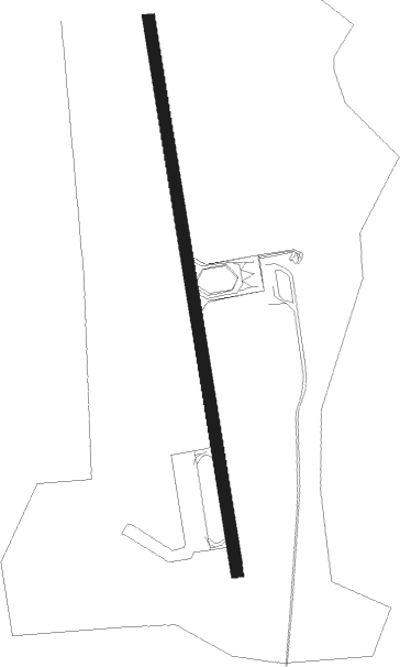
Lakselv - Banak
Airport details
| Country | Norway |
| State | Finnmark |
| Region | EN |
| Airspace | Polaris Ctr |
| Municipality | Porsanger |
| Elevation | 22ft (7m) |
| Timezone | GMT +1 |
| Coordinates | 70.06667, 24.97389 |
| Magnetic var | |
| Type | land |
| Available since | X-Plane v10.40 |
| ICAO code | ENNA |
| IATA code | LKL |
| FAA code | n/a |
Communication
| BANAK Tower | 118.900 |
| BANAK Tower | 122.100 |
| BANAK Tower | 118.050 |
Approach frequencies
| LOC | RW16 | 109.35 | 18.00mi |
| ILS-cat-I | RW34 | 108.3 | 18.00mi |
| 3.5° GS | RW34 | 108.3 | 18.00mi |
Nearby beacons
| code | identifier | dist | bearing | frequency |
|---|---|---|---|---|
| BNK | BANAK TACAN | 0.1 | 253° | 111 |
| BNR | BANAK (LAKSELV) NDB | 0.4 | 36° | 345 |
| BNA | BANAK VOR/DME | 6.6 | 347° | 114.40 |
| PG | PORSANG (LAKSELV) NDB | 10.2 | 169° | 275 |
Departure and arrival routes
| Transition altitude | 7000ft |
| SID end points | distance | outbound heading | |
|---|---|---|---|
| RW16 | |||
| BIGS1J | 21mi | 263° | |
| RW34 | |||
| DONE1K | 20mi | 273° | |
| STAR starting points | distance | inbound heading | |
|---|---|---|---|
| RW16 | |||
| LUVE1L | 58.6 | 78° | |
| LAPV1L | 24.2 | 121° | |
| ABAN1L | 21.3 | 266° | |
| RW34 | |||
| LUVE1M | 58.6 | 78° | |
| LAPV1M | 24.2 | 121° | |
| ABAN1M | 21.3 | 266° | |
Instrument approach procedures
| runway | airway (heading) | route (dist, bearing) |
|---|---|---|
| RW16 | BAXIN (213°) | BAXIN 4000ft NEPKO (5mi, 261°) 4000ft NA400 (4mi, 167°) 3200ft |
| RW16 | GUBEX (131°) | GUBEX 4000ft NEPKO (5mi, 95°) 4000ft NA400 (4mi, 167°) 3200ft |
| RW16 | NEPKO (167°) | NEPKO 4000ft NA400 (4mi, 167°) 3200ft |
| RNAV | NA400 3200ft ENNA (10mi, 167°) 65ft NA401 (17mi, 150°) PG (7mi, 310°) PG (turn) 5000ft | |
| RW34 | ODVIG (32°) | ODVIG 4800ft RIMIN (5mi, 81°) 4300ft NA405 (4mi, 347°) 3500ft |
| RW34 | RENBU (312°) | RENBU 4600ft RIMIN (5mi, 275°) 4300ft NA405 (4mi, 347°) 3500ft |
| RW34 | RISVO (347°) | RISVO 4800ft RIMIN (5mi, 347°) 4300ft NA405 (4mi, 347°) 3500ft |
| RNAV | NA405 3500ft ENNA (10mi, 347°) 75ft ENNA (turn) 2000ft NEPKO (14mi, 347°) NEPKO (turn) 4000ft |
Holding patterns
| STAR name | hold at | type | turn | heading* | altitude | leg | speed limit |
|---|---|---|---|---|---|---|---|
| LAPV1L | NEPKO | VHF | right | 344 (164)° | > 4000ft | 1.0min timed | ICAO rules |
| *) magnetic outbound (inbound) holding course | |||||||
Disclaimer
The information on this website is not for real aviation. Use this data with the X-Plane flight simulator only! Data taken with kind consent from X-Plane 12 source code and data files. Content is subject to change without notice.
