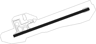
Namsos
Airport details
| Country | Norway |
| State | Nord-Trøndelag |
| Region | EN |
| Airspace | Polaris Ctr |
| Municipality | Namsos |
| Elevation | 3ft (1m) |
| Timezone | GMT +1 |
| Coordinates | 64.47222, 11.57861 |
| Magnetic var | |
| Type | land |
| Available since | X-Plane v10.40 |
| ICAO code | ENNM |
| IATA code | OSY |
| FAA code | n/a |
Communication
Nearby beacons
| code | identifier | dist | bearing | frequency |
|---|---|---|---|---|
| NA | DME-ILS | 0.3 | 264° | 108.50 |
| NMS | NAMSOS NDB | 6.1 | 84° | 329 |
| LVK | LEIRVIKA NDB | 7.7 | 263° | 284 |
| RVK | RORVIK VOR/DME | 24.5 | 310° | 112.70 |
| BNN | BRONNOY VOR/DME | 61.3 | 33° | 115.30 |
Instrument approach procedures
| runway | airway (heading) | route (dist, bearing) |
|---|---|---|
| RW07 | BAKAR (93°) | BAKAR 4000ft ULROP (5mi, 147°) 3300ft |
| RW07 | GOPIG (83°) | GOPIG 4000ft ULROP (5mi, 83°) 3300ft |
| RW07 | OTSEX (71°) | OTSEX 4000ft ULROP (5mi, 327°) 3300ft |
| RNAV | ULROP 3300ft NM410 (5mi, 83°) 3000ft ENNM (7mi, 83°) 57ft NIPIX (12mi, 83°) NIPIX (turn) 4000ft | |
| RW25 | ALIGU (263°) | ALIGU 4900ft NIPIX (5mi, 263°) 3800ft |
| RW25 | MOKAV (252°) | MOKAV 4000ft NIPIX (5mi, 148°) 3800ft |
| RW25 | NANAB (273°) | NANAB 4300ft NIPIX (5mi, 328°) 3800ft |
| RNAV | NIPIX 3800ft NM400 (6mi, 263°) 2500ft ENNM (6mi, 263°) 58ft ULROP (12mi, 263°) ULROP (turn) 4000ft |
Disclaimer
The information on this website is not for real aviation. Use this data with the X-Plane flight simulator only! Data taken with kind consent from X-Plane 12 source code and data files. Content is subject to change without notice.
