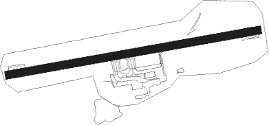
Sandane
Airport details
| Country | Norway |
| State | Sogn og Fjordane |
| Region | EN |
| Airspace | Polaris Ctr |
| Municipality | Gloppen |
| Elevation | 194ft (59m) |
| Timezone | GMT +1 |
| Coordinates | 61.83000, 6.10583 |
| Magnetic var | |
| Type | land |
| Available since | X-Plane v10.40 |
| ICAO code | ENSD |
| IATA code | SDN |
| FAA code | n/a |
Communication
| Sandane AFIS | 119.800 |
Approach frequencies
| LOC | RW26 | 108.3 | 18.00mi |
Nearby beacons
| code | identifier | dist | bearing | frequency |
|---|---|---|---|---|
| AD | ANDA NDB | 0.2 | 92° | 288 |
| STG | STEGEN NDB | 7.6 | 83° | 369 |
| HN | HOVDEN NDB | 20.1 | 346° | 389 |
| BVK | BAATVIK NDB | 26 | 324° | 362 |
| BL | BRINGELAND NDB | 28.2 | 218° | 374 |
| VNG | VANGSNES NDB | 42.3 | 141° | 404 |
| VIG | VIGRA VOR/DME | 43.4 | 354° | 115.80 |
| TAT | TAUTRA (MOLDE) NDB | 55.7 | 43° | 393 |
Departure and arrival routes
| Transition altitude | 6000ft |
| SID end points | distance | outbound heading | |
|---|---|---|---|
| RW08 | |||
| EVNA1A | 26mi | 109° | |
| LOGS1A | 15mi | 294° | |
| RW26 | |||
| EVNA1B | 26mi | 109° | |
| LOGS1B | 15mi | 294° | |
| STAR starting points | distance | inbound heading | |
|---|---|---|---|
| RW26 | |||
| BATP1P | 51.0 | 280° | |
| EVNA1P | 26.3 | 289° | |
Instrument approach procedures
| runway | airway (heading) | route (dist, bearing) |
|---|---|---|
| RW08 | ETNEK (112°) | ETNEK 6700ft KUVOV (4mi, 224°) 5800ft |
| RW08 | OKPAS (94°) | OKPAS 6600ft KUVOV (4mi, 44°) 5800ft |
| RNAV | KUVOV 5800ft GIRER (4mi, 102°) 5000ft SD400 (6mi, 102°) 2137ft SD401 (7mi, 102°) (3723mi, 186°) KUVOV (3728mi, 5°) 5800ft KUVOV (turn) 5800ft | |
| RW26 | GIGMU (253°) | GIGMU 6800ft ITVAK (4mi, 146°) 6800ft |
| RW26 | OGDIT (269°) | OGDIT 6800ft ITVAK (4mi, 326°) 6800ft |
| RNAV | ITVAK 6800ft NUNKI (4mi, 261°) 6000ft SD500 (9mi, 261°) 734ft SD500 (turn) 3500ft ITVAK (13mi, 81°) 6800ft ITVAK (turn) 6800ft |
Disclaimer
The information on this website is not for real aviation. Use this data with the X-Plane flight simulator only! Data taken with kind consent from X-Plane 12 source code and data files. Content is subject to change without notice.
